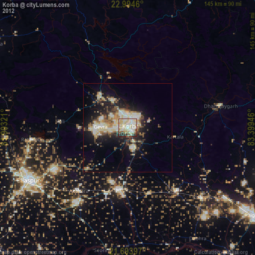
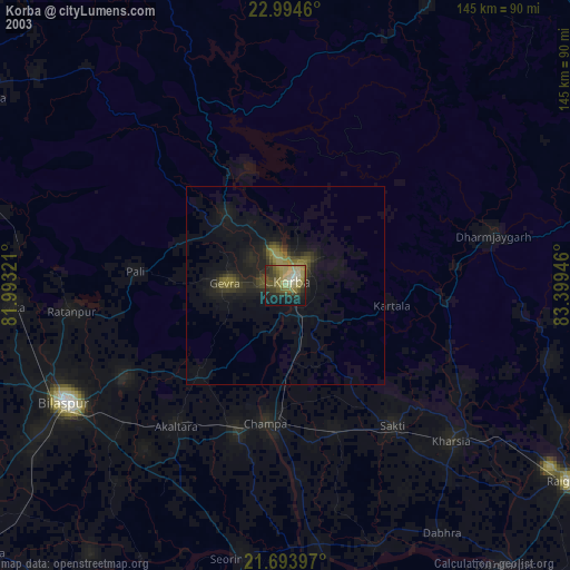
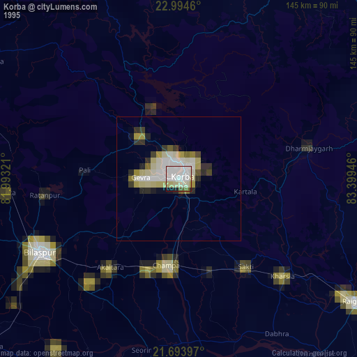
Korba night lights from space
Night Light of Korba (Chhattisgarh) from space (India) Src. Average luminocity for 10x10km area is 91.803% and for 50x50km: 30.5265%.
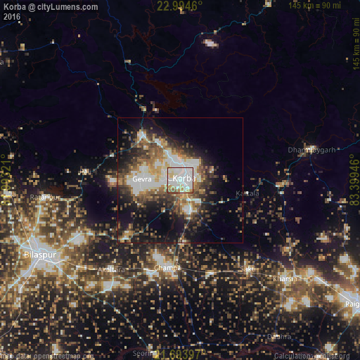
Analysis of Korba night lights 2016
Square area 10x10 km:
 47.73%
90-99
26.14%80-89
8.14%70-79
7.77%60-69
5.3%50-59
4.17%40-49
0.76%30-39
0%20-29
0%10-19
0%0-9
0%Square area 50x50 km:
6.23%90-99
5.75%80-89
2.6%70-79
3.85%60-69
3.53%50-59
5.2%40-49
5.15%30-39
5.5%20-29
6.51%10-19
13.15%0-9
42.53%Clear (daylight) street map image can be seen on geolist.org.
Map coordinates:
22° 59' 40.6" North, 81° 59' 35.6" East
22° 20' 44.9" North, 82° 41' 46.8" East
21° 41' 38.3" North, 83° 23' 58.1" East
Some cities around Korba sort by population:
• Chāmpa
35 km =21.7 mi,  189°
189°
• Jānjgīr
39.4 km =24.5 mi,  198°
198°
• Saktī
44.7 km =27.8 mi,  142°
142°
• Ratanpur
54.7 km =34 mi,  263°
263°
• Akaltara
45.2 km =28.1 mi,  217°
217°
• Katghora
23.5 km =14.6 mi,  317°
317°
• Kharsia
57.8 km =35.9 mi,  133°
133°
• Baloda
31.9 km =19.8 mi, 223°
1266122 (p: 419,146)
Sources (retrieved 2019-11-25):
» NASA, Earths city lights 1995
» NASA city lights 2003
» Earth at Night: Flat Maps 2012, 2016