Chāmpa night lights from space
Night Light of Chāmpa (Chhattisgarh) from space (India) Src. Average luminocity for 10x10km area is 75.006% and for 50x50km: 25.878%.
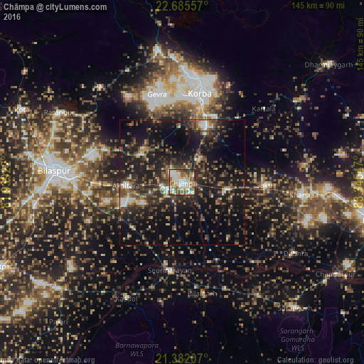
Analysis of Chāmpa night lights 2016
Square area 10x10 km:
 18.06%
90-99
20.04%80-89
11.51%70-79
8.53%60-69
9.92%50-59
15.08%40-49
10.32%30-39
4.96%20-29
1.59%10-19
0%0-9
0%Square area 50x50 km:
1.87%90-99
2.92%80-89
1.95%70-79
2.22%60-69
3.04%50-59
5.58%40-49
6.65%30-39
7.25%20-29
10.49%10-19
23.37%0-9
34.66%Clear (daylight) street map image can be seen on geolist.org.
Map coordinates:
22° 41' 8.1" North, 81° 56' 21.2" East
22° 2' 7.2" North, 82° 38' 32.4" East
21° 22' 55.5" North, 83° 20' 43.7" East
Some cities around Chāmpa sort by population:
• Korba
35 km =21.7 mi,  9°
9°
• Jānjgīr
7.3 km =4.5 mi,  246°
246°
• Saktī
32.8 km =20.4 mi,  91°
91°
• Akaltara
22.3 km =13.9 mi,  266°
266°
• Kharsia
47.9 km =29.8 mi,  96°
96°
• Baloda
20.2 km =12.6 mi,  304°
304°
• Kharod
33 km =20.5 mi,  191°
191°
• Seorīnārāyan
35.4 km =22 mi, 188°
1274837 (p: 41,252)
Sources (retrieved 2019-11-25):
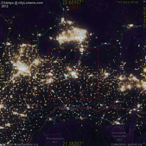
» Earth at Night: Flat Maps 2012, 2016