Ropar night lights from space
Night Light of Ropar (Punjab) from space (India) Src. Average luminocity for 10x10km area is 49.5275% and for 50x50km: 21.7586%.
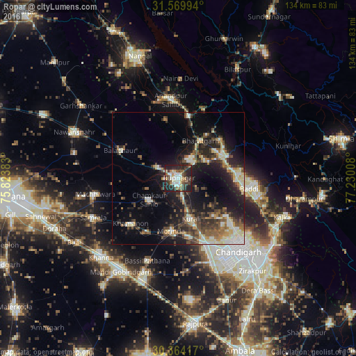

Analysis of Ropar night lights 2016
Square area 10x10 km:
 6.41%
6.41%90-99
13.55%80-89
4.95%70-79
3.3%60-69
6.04%50-59
6.04%40-49
7.33%30-39
14.84%20-29
25.82%10-19
11.72%0-9
0%Square area 50x50 km:
2.06%90-99
4.14%80-89
2.59%70-79
1.77%60-69
2.47%50-59
3.35%40-49
4.27%30-39
4.57%20-29
7.57%10-19
14.39%0-9
52.82%Clear (daylight) street map image can be seen on geolist.org.
Map coordinates:
31° 34' 11.8" North, 75° 49' 25.8" East
30° 58' 8.3" North, 76° 31' 37" East
30° 21' 51" North, 77° 13' 48.3" East
Some cities around Ropar sort by population:
• Kharar
27.3 km =17 mi,  155°
155°
• Morinda
20.1 km =12.5 mi,  187°
187°
• Baddi
25.2 km =15.7 mi,  92°
92°
• Bālāchor
23.8 km =14.8 mi,  295°
295°
• Anandpur
30.1 km =18.7 mi,  355°
355°
• Nālāgarh
20.3 km =12.6 mi,  66°
66°
• Nūrpur Kalān
22.4 km =13.9 mi,  349°
349°
• Khamānon Kalān
23.5 km =14.6 mi,  224°
224°
1257951 (p: 52,313)
Sources (retrieved 2019-11-25):
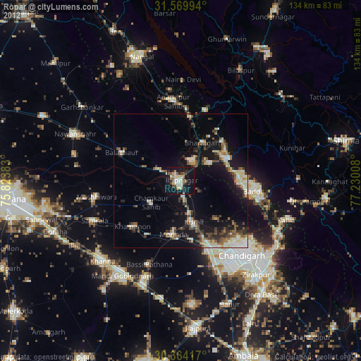
» NASA, Earths city lights 1995
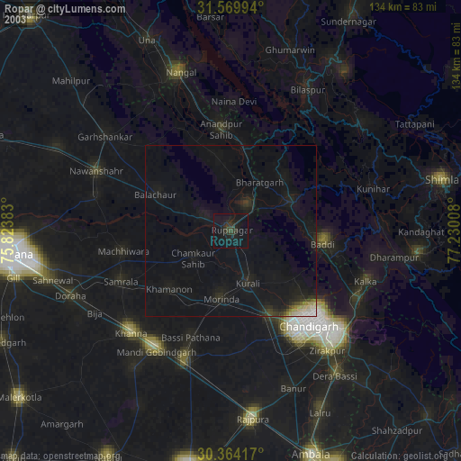
» NASA city lights 2003
» Earth at Night: Flat Maps 2012, 2016