Barnāla night lights from space
Night Light of Barnāla (Punjab) from space (India) Src. Average luminocity for 10x10km area is 51.315% and for 50x50km: 14.9792%.
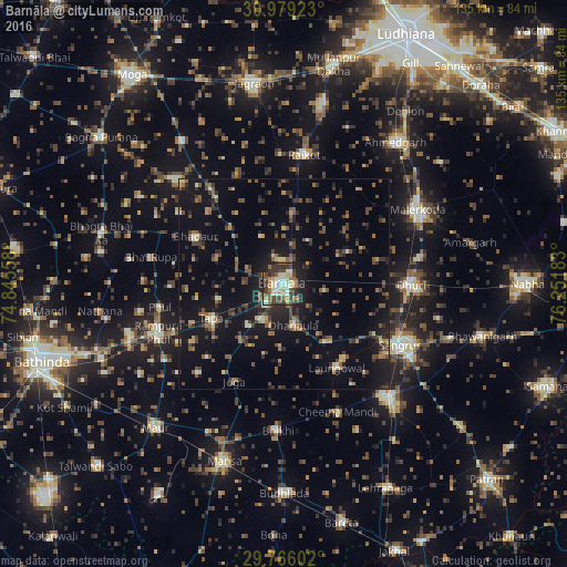
Analysis of Barnāla night lights 2016
Square area 10x10 km:
 5.31%
5.31%90-99
11.36%80-89
9.16%70-79
3.85%60-69
8.79%50-59
7.51%40-49
10.99%30-39
13.74%20-29
13.55%10-19
15.75%0-9
0%Square area 50x50 km:
0.37%90-99
1.13%80-89
1.44%70-79
1.33%60-69
1.96%50-59
3.16%40-49
3.56%30-39
3.63%20-29
4.36%10-19
13.83%0-9
65.23%Clear (daylight) street map image can be seen on geolist.org.
Map coordinates:
30° 58' 45.2" North, 74° 50' 44.1" East
30° 22' 28.2" North, 75° 32' 55.3" East
29° 45' 57.7" North, 76° 15' 6.6" East
Some cities around Barnāla sort by population:
• Sangrūr
31.9 km =19.8 mi,  116°
116°
• Dhūri
30.6 km =19 mi,  91°
91°
• Rāmpura
32.3 km =20.1 mi,  245°
245°
• Rāikot
31 km =19.3 mi,  9°
9°
• Laungowāl
23.8 km =14.8 mi,  147°
147°
• Dhanaula
10.5 km =6.5 mi,  166°
166°
• Bhadaur
23.8 km =14.8 mi,  298°
298°
• Bhīkhi
35.1 km =21.8 mi,  182°
182°
1276895 (p: 105,016)
Sources (retrieved 2019-11-25):
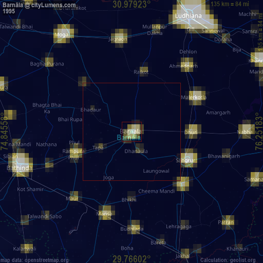
» NASA, Earths city lights 1995
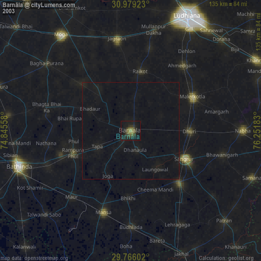
» NASA city lights 2003
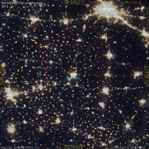
» Earth at Night: Flat Maps 2012, 2016