Rāmpur night lights from space
Night Light of Rāmpur (Uttar Pradesh) from space (India) Src. Average luminocity for 10x10km area is 28.4643% and for 50x50km: 32.5645%.
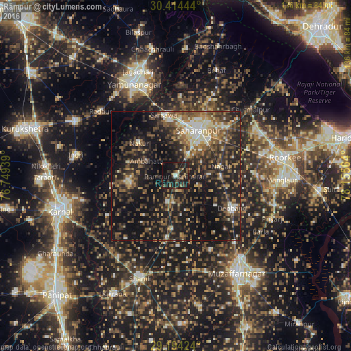
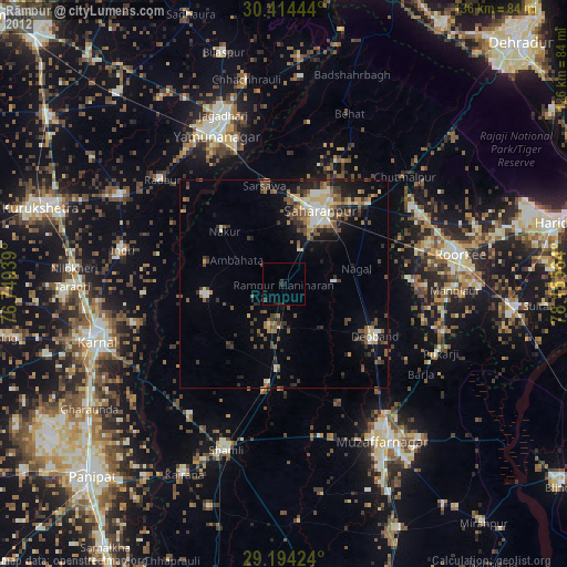
Analysis of Rāmpur night lights 2016
Square area 10x10 km:
 0.2%
0.2%90-99
3.57%80-89
1.79%70-79
0.79%60-69
4.76%50-59
5.16%40-49
6.94%30-39
9.33%20-29
16.07%10-19
42.46%0-9
8.93%Square area 50x50 km:
2.05%90-99
3.98%80-89
3.23%70-79
3.35%60-69
4.47%50-59
6.95%40-49
9.07%30-39
7.36%20-29
13.44%10-19
29.1%0-9
17%Clear (daylight) street map image can be seen on geolist.org.
Map coordinates:
30° 24' 52" North, 76° 44' 57.8" East
29° 48' 22.3" North, 77° 27' 9" East
29° 11' 39.3" North, 78° 9' 20.3" East
Some cities around Rāmpur sort by population:
• Sahāranpur
20.1 km =12.5 mi,  26°
26°
• Gangoh
18.5 km =11.5 mi,  260°
260°
• Thāna Bhawan
24.7 km =15.3 mi,  187°
187°
• Jalālābad
20.9 km =13 mi,  183°
183°
• Nakūr
19.1 km =11.9 mi,  311°
311°
• Nanauta
11 km =6.8 mi,  198°
198°
• Ambahta
12.6 km =7.8 mi,  296°
296°
• Titron
19.7 km =12.2 mi,  218°
218°
1258598 (p: 26,257)
Sources (retrieved 2019-11-25):
» Earth at Night: Flat Maps 2012, 2016