Jalālābad night lights from space
Night Light of Jalālābad (Uttar Pradesh) from space (India) Src. Average luminocity for 10x10km area is 34.1766% and for 50x50km: 31.0308%.
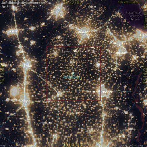
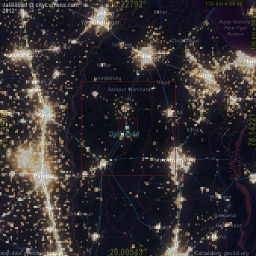
Analysis of Jalālābad night lights 2016
Square area 10x10 km:
 0.6%
0.6%90-99
2.38%80-89
3.37%70-79
3.37%60-69
2.98%50-59
12.7%40-49
8.53%30-39
6.75%20-29
17.26%10-19
42.06%0-9
0%Square area 50x50 km:
1.5%90-99
3.04%80-89
2.51%70-79
2.95%60-69
3.84%50-59
5.89%40-49
9.39%30-39
7.75%20-29
14.95%10-19
38.45%0-9
9.72%Clear (daylight) street map image can be seen on geolist.org.
Map coordinates:
30° 13' 40.5" North, 76° 44' 9.5" East
29° 37' 6.7" North, 77° 26' 20.7" East
29° 0' 19.5" North, 78° 8' 32" East
Some cities around Jalālābad sort by population:
• Thāna Bhawan
4.1 km =2.5 mi,  209°
209°
• Rāmpur
20.9 km =13 mi,  3°
3°
• Banat
19.1 km =11.9 mi, 205°
• Charthāwal
17 km =10.6 mi,  117°
117°
• Nanauta
10.6 km =6.6 mi,  348°
348°
• Ūn
18.1 km =11.2 mi,  258°
258°
• Garhi Pūkhta
14.7 km =9.1 mi,  238°
238°
• Titron
12.4 km =7.7 mi,  296°
296°
1269446 (p: 25,302)
Sources (retrieved 2019-11-25):
» Earth at Night: Flat Maps 2012, 2016