Rabkavi night lights from space
Night Light of Rabkavi (Karnataka) from space (India) Src. Average luminocity for 10x10km area is 30.719% and for 50x50km: 8.2063%.
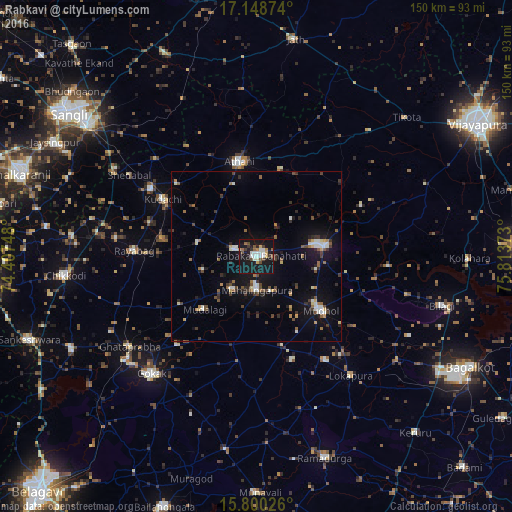
Analysis of Rabkavi night lights 2016
Square area 10x10 km:
 4.55%
4.55%90-99
7.02%80-89
1.65%70-79
2.69%60-69
2.07%50-59
3.93%40-49
4.96%30-39
2.69%20-29
3.31%10-19
60.74%0-9
6.4%Square area 50x50 km:
0.88%90-99
1.2%80-89
0.57%70-79
0.5%60-69
0.79%50-59
1.21%40-49
1.36%30-39
1.36%20-29
1.65%10-19
7.49%0-9
82.98%Clear (daylight) street map image can be seen on geolist.org.
Map coordinates:
17° 8' 55.5" North, 74° 24' 26.9" East
16° 28' 32.4" North, 75° 6' 38.2" East
15° 48' 0.9" North, 75° 48' 49.4" East
Some cities around Rabkavi sort by population:
• Jamkhandi
19.5 km =12.1 mi,  80°
80°
• Mudhol
24.3 km =15.1 mi,  130°
130°
• Athni
28.3 km =17.6 mi,  349°
349°
• Mahālingpur
9.7 km =6 mi,  181°
181°
• Terdāl
7.1 km =4.4 mi,  286°
286°
• Shiraguppi
45.7 km =28.4 mi, 290°
• Kudachi
32.2 km =20 mi,  301°
301°
• Rāybāg
35.9 km =22.3 mi,  272°
272°
1259083 (p: 73,835)
Sources (retrieved 2019-11-25):
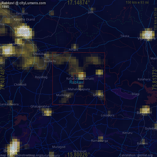
» NASA, Earths city lights 1995
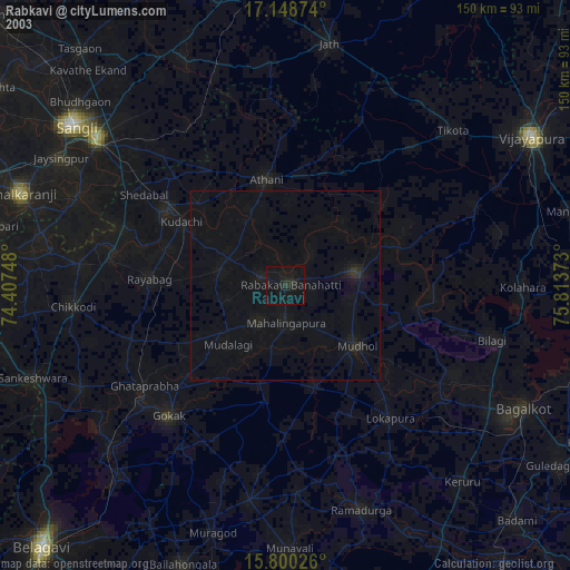
» NASA city lights 2003
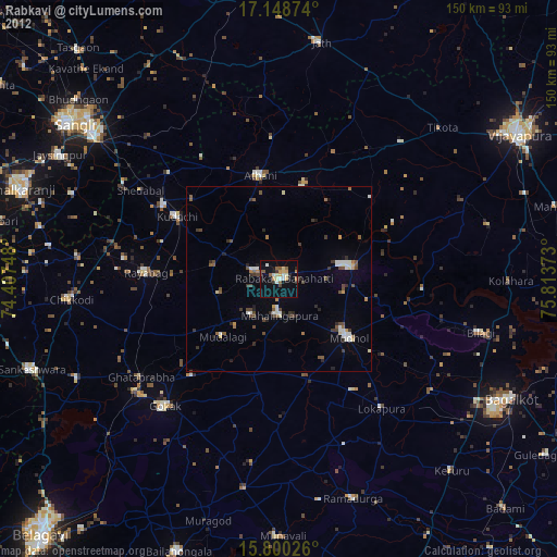
» Earth at Night: Flat Maps 2012, 2016