Kudachi night lights from space
Night Light of Kudachi (Karnataka) from space (India) Src. Average luminocity for 10x10km area is 20.5931% and for 50x50km: 8.54%.
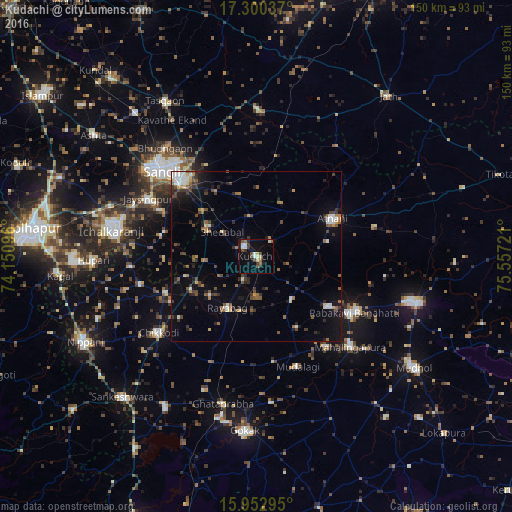
Analysis of Kudachi night lights 2016
Square area 10x10 km:
 2.6%
2.6%90-99
3.9%80-89
2.16%70-79
0.87%60-69
1.3%50-59
3.68%40-49
4.55%30-39
2.81%20-29
3.9%10-19
8.44%0-9
65.8%Square area 50x50 km:
0.65%90-99
1.23%80-89
0.66%70-79
0.39%60-69
1.16%50-59
1.43%40-49
1.6%30-39
1.74%20-29
2.07%10-19
4.37%0-9
84.7%Clear (daylight) street map image can be seen on geolist.org.
Map coordinates:
17° 18' 1.3" North, 74° 9' 3.5" East
16° 37' 40.2" North, 74° 51' 14.7" East
15° 57' 10.6" North, 75° 33' 26" East
Some cities around Kudachi sort by population:
• Rabkavi
32.2 km =20 mi,  121°
121°
• Jaisingpur
36 km =22.4 mi,  297°
297°
• Athni
24.9 km =15.5 mi,  63°
63°
• Terdāl
25.4 km =15.8 mi,  125°
125°
• Shiraguppi
15.5 km =9.6 mi,  266°
266°
• Sadalgi
35.2 km =21.9 mi,  257°
257°
• Kurandvād
28.9 km =18 mi,  282°
282°
• Rāybāg
17.4 km =10.8 mi,  209°
209°
1265811 (p: 19,272)
Sources (retrieved 2019-11-25):
» Earth at Night: Flat Maps 2012, 2016