Puruliya night lights from space
Night Light of Puruliya (West Bengal) from space (India) Src. Average luminocity for 10x10km area is 49.9508% and for 50x50km: 5.2078%.
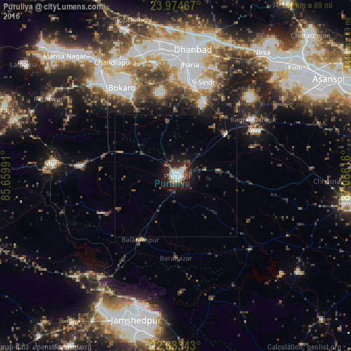
Analysis of Puruliya night lights 2016
Square area 10x10 km:
 11.55%
90-99
13.07%80-89
3.41%70-79
3.79%60-69
5.49%50-59
6.25%40-49
6.82%30-39
9.66%20-29
14.02%10-19
24.43%0-9
1.52%Square area 50x50 km:
0.55%90-99
0.63%80-89
0.2%70-79
0.25%60-69
0.42%50-59
0.8%40-49
1.16%30-39
1.76%20-29
1.91%10-19
4.32%0-9
87.99%Clear (daylight) street map image can be seen on geolist.org.
Map coordinates:
23° 58' 28.8" North, 85° 39' 35.7" East
23° 19' 50.2" North, 86° 21' 46.9" East
22° 41' 0.3" North, 87° 3' 58.2" East
Some cities around Puruliya sort by population:
• Chās
39.4 km =24.5 mi,  329°
329°
• Pāthardih
37.9 km =23.5 mi,  10°
10°
• Balarāmpur
29.6 km =18.4 mi,  208°
208°
• Raghunathpur
39.2 km =24.4 mi,  53°
53°
• Adra
37.6 km =23.4 mi,  60°
60°
• Jhalidā
39.7 km =24.7 mi,  275°
275°
• Kenda
21.6 km =13.4 mi,  133°
133°
• Bhojudih
35.3 km =21.9 mi, 13°
1259163 (p: 122,533)
Sources (retrieved 2019-11-25):
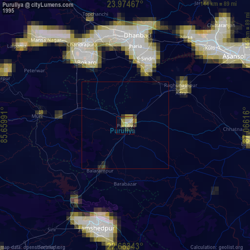
» NASA, Earths city lights 1995
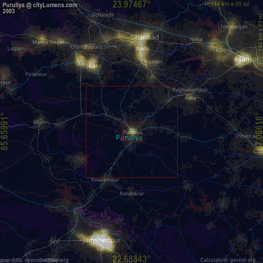
» NASA city lights 2003
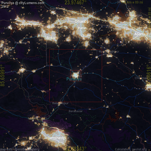
» Earth at Night: Flat Maps 2012, 2016