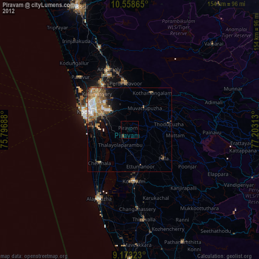
Piravam night lights from space
Night Light of Piravam (Kerala) from space (India) Src. Average luminocity for 10x10km area is 1.7511% and for 50x50km: 13.1031%.
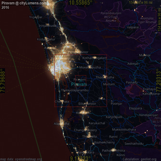
Analysis of Piravam night lights 2016
Square area 10x10 km:
 0%
0%90-99
0%80-89
0%70-79
0%60-69
0%50-59
0.65%40-49
0.22%30-39
1.3%20-29
3.03%10-19
0%0-9
94.81%Square area 50x50 km:
1.81%90-99
2.71%80-89
2.11%70-79
2.79%60-69
1.98%50-59
1.65%40-49
1.24%30-39
1.82%20-29
2.11%10-19
3.38%0-9
78.4%Clear (daylight) street map image can be seen on geolist.org.
Map coordinates:
10° 33' 31.1" North, 75° 47' 48.8" East
9° 52' 0" North, 76° 30' 0" East
9° 10' 23.6" North, 77° 12' 11.3" East
Some cities around Piravam sort by population:
• Aroor
21.4 km =13.3 mi,  270°
270°
• Mūvattupula
15.6 km =9.7 mi,  32°
32°
• Muvattupuzha
15 km =9.3 mi, 32°
• Kumbalam
21.1 km =13.1 mi,  282°
282°
• Kutiatodu
19.7 km =12.2 mi,  247°
247°
• Vaikam
17.4 km =10.8 mi,  220°
220°
• Arukutti
16.4 km =10.2 mi, 270°
• Rāmamangalam
7.4 km =4.6 mi,  0°
0°
1259541 (p: 28,254)
Sources (retrieved 2019-11-25):
» Earth at Night: Flat Maps 2012, 2016