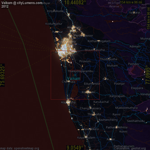
Vaikam night lights from space
Night Light of Vaikam (Kerala) from space (India) Src. Average luminocity for 10x10km area is 3.2684% and for 50x50km: 8.1902%.
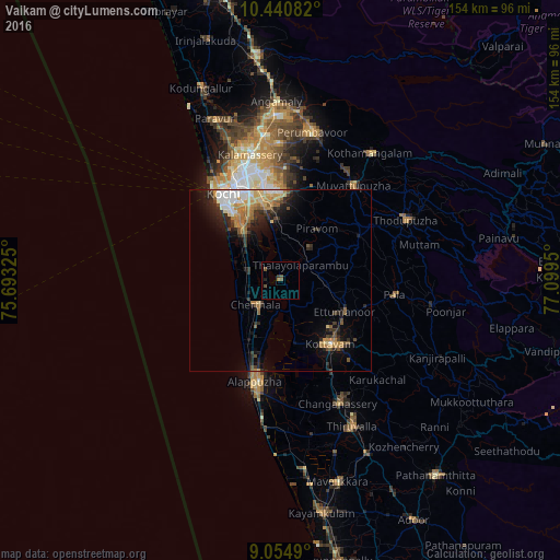
Analysis of Vaikam night lights 2016
Square area 10x10 km:
 0%
0%90-99
0%80-89
0%70-79
0.65%60-69
0.22%50-59
1.52%40-49
1.95%30-39
0.87%20-29
0%10-19
0.87%0-9
93.94%Square area 50x50 km:
1.05%90-99
1.21%80-89
0.94%70-79
1.4%60-69
1.41%50-59
1.06%40-49
0.75%30-39
1.43%20-29
2.43%10-19
3.94%0-9
84.38%Clear (daylight) street map image can be seen on geolist.org.
Map coordinates:
10° 26' 27" North, 75° 41' 35.7" East
9° 44' 54.9" North, 76° 23' 46.9" East
9° 3' 17.6" North, 77° 5' 58.2" East
Some cities around Vaikam sort by population:
• Cherthala
9.8 km =6.1 mi,  223°
223°
• Shertallai
9.3 km =5.8 mi, 221°
• Aroor
16.8 km =10.4 mi,  323°
323°
• Piravam
17.4 km =10.8 mi,  40°
40°
• Vayalār
7.5 km =4.7 mi,  236°
236°
• Kumbalam
19.9 km =12.4 mi,  332°
332°
• Kutiatodu
9 km =5.6 mi,  309°
309°
• Arukutti
14.1 km =8.8 mi,  338°
338°
1253544 (p: 22,807)
Sources (retrieved 2019-11-25):
» Earth at Night: Flat Maps 2012, 2016