Phagwāra night lights from space
Night Light of Phagwāra (Punjab) from space (India) Src. Average luminocity for 10x10km area is 53.0256% and for 50x50km: 21.4515%.
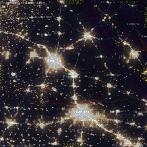
Analysis of Phagwāra night lights 2016
Square area 10x10 km:
 6.04%
6.04%90-99
17.77%80-89
6.78%70-79
6.04%60-69
4.95%50-59
6.59%40-49
4.76%30-39
13%20-29
17.58%10-19
15.57%0-9
0.92%Square area 50x50 km:
3.08%90-99
5.02%80-89
1.81%70-79
1.54%60-69
2.18%50-59
3.22%40-49
3.57%30-39
4%20-29
6.19%10-19
13.92%0-9
55.47%Clear (daylight) street map image can be seen on geolist.org.
Map coordinates:
31° 49' 25.9" North, 75° 4' 14.7" East
31° 13' 28.3" North, 75° 46' 25.9" East
30° 37' 16.8" North, 76° 28' 37.2" East
Some cities around Phagwāra sort by population:
• Jalandhar
21.6 km =13.4 mi,  301°
301°
• Nakodar
30.5 km =19 mi,  248°
248°
• Jandiāla
16.5 km =10.3 mi,  244°
244°
• Phillaur
22.9 km =14.2 mi,  175°
175°
• Banga
21.4 km =13.3 mi,  100°
100°
• Adampur
23.8 km =14.8 mi,  346°
346°
• Nūrmahal
22.3 km =13.9 mi,  230°
230°
• Alāwalpur
25.6 km =15.9 mi,  334°
334°
1259827 (p: 100,146)
Sources (retrieved 2019-11-25):
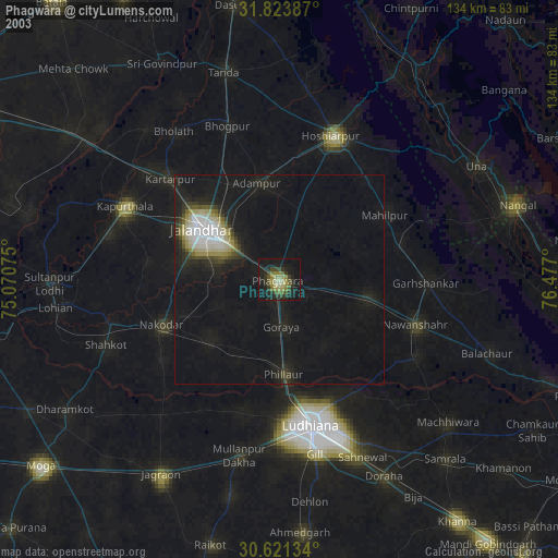
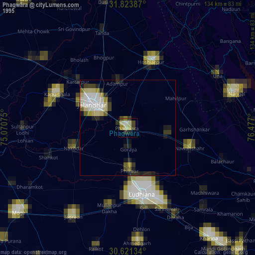
» NASA, Earths city lights 1995
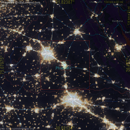
» NASA city lights 2003
» Earth at Night: Flat Maps 2012, 2016