Jalandhar night lights from space
Night Light of Jalandhar (Punjab) from space (India) Src. Average luminocity for 10x10km area is 97.1381% and for 50x50km: 27.1883%.
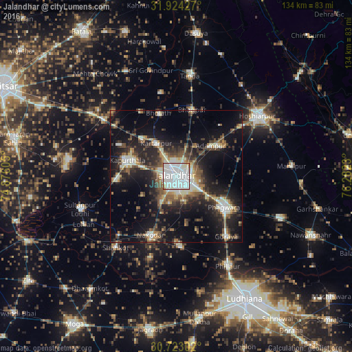
Analysis of Jalandhar night lights 2016
Square area 10x10 km:
 52.27%
90-99
41.96%80-89
1.4%70-79
1.57%60-69
2.1%50-59
0.7%40-49
0%30-39
0%20-29
0%10-19
0%0-9
0%Square area 50x50 km:
3.45%90-99
6.08%80-89
2.29%70-79
2.04%60-69
2.88%50-59
4.12%40-49
4.85%30-39
5.27%20-29
9.41%10-19
18.77%0-9
40.85%Clear (daylight) street map image can be seen on geolist.org.
Map coordinates:
31° 55' 27.4" North, 74° 52' 33.8" East
31° 19' 32" North, 75° 34' 45" East
30° 43' 22.9" North, 76° 16' 56.3" East
Some cities around Jalandhar sort by population:
• Phagwāra
21.6 km =13.4 mi,  121°
121°
• Kapūrthala
19.8 km =12.3 mi,  287°
287°
• Nakodar
24.3 km =15.1 mi,  204°
204°
• Kartārpur
15.1 km =9.4 mi,  329°
329°
• Jandiāla
18.8 km =11.7 mi,  168°
168°
• Adampur
17.5 km =10.9 mi,  47°
47°
• Bhulath Gharbi
25.1 km =15.6 mi,  344°
344°
• Alāwalpur
13.9 km =8.6 mi,  31°
31°
1268782 (p: 785,178)
Sources (retrieved 2019-11-25):
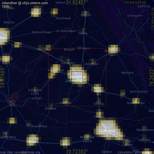
» NASA, Earths city lights 1995
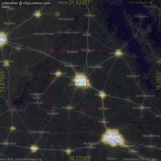
» NASA city lights 2003
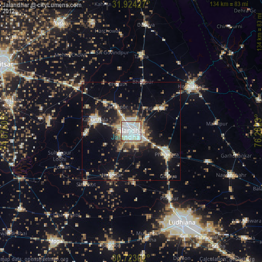
» Earth at Night: Flat Maps 2012, 2016