Pawai night lights from space
Night Light of Pawai (Madhya Pradesh) from space (India) Src. Average luminocity for 10x10km area is 5.9905% and for 50x50km: 2.2323%.
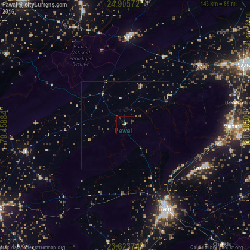
Analysis of Pawai night lights 2016
Square area 10x10 km:
 0%
0%90-99
1.33%80-89
0.95%70-79
0%60-69
0.76%50-59
0.38%40-49
2.84%30-39
1.7%20-29
1.52%10-19
0.57%0-9
89.96%Square area 50x50 km:
0.16%90-99
0.18%80-89
0.21%70-79
0.2%60-69
0.45%50-59
0.39%40-49
0.53%30-39
0.4%20-29
0.78%10-19
0.59%0-9
96.12%Clear (daylight) street map image can be seen on geolist.org.
Map coordinates:
24° 54' 20.6" North, 79° 27' 31.8" East
24° 15' 58.9" North, 80° 9' 43.1" East
23° 37' 25.5" North, 80° 51' 54.3" East
Some cities around Pawai sort by population:
• Murwāra
53.2 km =33.1 mi,  153°
153°
• Panna
50.6 km =31.4 mi,  2°
2°
• Maihar
60.7 km =37.7 mi,  90°
90°
• Hatta
58.7 km =36.5 mi,  255°
255°
• Khajuraho Group of Monuments
68.7 km =42.7 mi,  340°
340°
• Nāgod
54.7 km =34 mi,  52°
52°
• Ajaigarh
71 km =44.1 mi,  7°
7°
• Amānganj
21.9 km =13.6 mi,  324°
324°
1260009 (p: 13,083)
Sources (retrieved 2019-11-25):
» Earth at Night: Flat Maps 2012, 2016