Patti night lights from space
Night Light of Patti (Punjab) from space (India) Src. Average luminocity for 10x10km area is 41.0437% and for 50x50km: 27.223%.
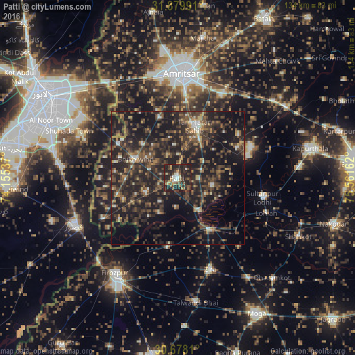
Analysis of Patti night lights 2016
Square area 10x10 km:
 1.05%
1.05%90-99
7.52%80-89
1.92%70-79
3.5%60-69
8.22%50-59
6.47%40-49
13.29%30-39
10.49%20-29
36.01%10-19
11.54%0-9
0%Square area 50x50 km:
0.76%90-99
2.46%80-89
1.73%70-79
2.15%60-69
3.57%50-59
4.99%40-49
9.27%30-39
9.55%20-29
16.06%10-19
26.6%0-9
22.84%Clear (daylight) street map image can be seen on geolist.org.
Map coordinates:
31° 52' 47.7" North, 74° 9' 19.3" East
31° 16' 51.3" North, 74° 51' 30.6" East
30° 40' 41.2" North, 75° 33' 41.8" East
Some cities around Patti sort by population:
• Amritsar
38 km =23.6 mi,  2°
2°
• Kasur, PK
42.8 km =26.6 mi,  245°
245°
• Tarn Tāran
20.1 km =12.5 mi,  19°
19°
• Zira
37 km =23 mi,  160°
160°
• Sultanpur
32.9 km =20.4 mi,  102°
102°
• Makhu
23.7 km =14.7 mi,  146°
146°
• Khem Karan
32.2 km =20 mi,  241°
241°
• Jandiāla Gurū
35.1 km =21.8 mi,  27°
27°
1260045 (p: 37,087)
Sources (retrieved 2019-11-25):
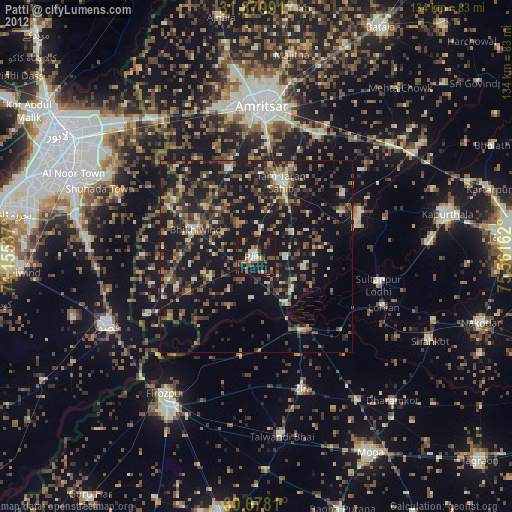
» Earth at Night: Flat Maps 2012, 2016