Makhu night lights from space
Night Light of Makhu (Punjab) from space (India) Src. Average luminocity for 10x10km area is 23.0623% and for 50x50km: 14.9967%.
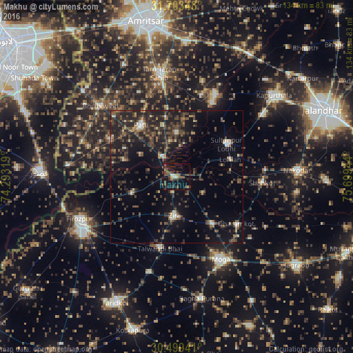
Analysis of Makhu night lights 2016
Square area 10x10 km:
 0.92%
0.92%90-99
2.01%80-89
0.55%70-79
2.38%60-69
2.38%50-59
5.31%40-49
9.89%30-39
6.96%20-29
3.85%10-19
30.59%0-9
35.16%Square area 50x50 km:
0.37%90-99
1.56%80-89
0.79%70-79
0.77%60-69
1.62%50-59
2.67%40-49
5.04%30-39
4.45%20-29
7.69%10-19
12.7%0-9
62.33%Clear (daylight) street map image can be seen on geolist.org.
Map coordinates:
31° 42' 12.5" North, 74° 17' 35.5" East
31° 6' 12.1" North, 74° 59' 46.7" East
30° 29' 57.9" North, 75° 41' 58" East
Some cities around Makhu sort by population:
• Moga
36.1 km =22.4 mi,  152°
152°
• Tarn Tāran
39.3 km =24.4 mi,  350°
350°
• Patti
23.7 km =14.7 mi,  326°
326°
• Zira
15 km =9.3 mi,  181°
181°
• Talwandi Bhai
28.2 km =17.5 mi,  192°
192°
• Sultanpur
22.7 km =14.1 mi,  56°
56°
• Shāhkot
32.5 km =20.2 mi,  94°
94°
• Kot Īsa Khān
22 km =13.7 mi,  142°
142°
1264215 (p: 12,886)
Sources (retrieved 2019-11-25):
» Earth at Night: Flat Maps 2012, 2016