Zira night lights from space
Night Light of Zira (Punjab) from space (India) Src. Average luminocity for 10x10km area is 22.9377% and for 50x50km: 12.4562%.
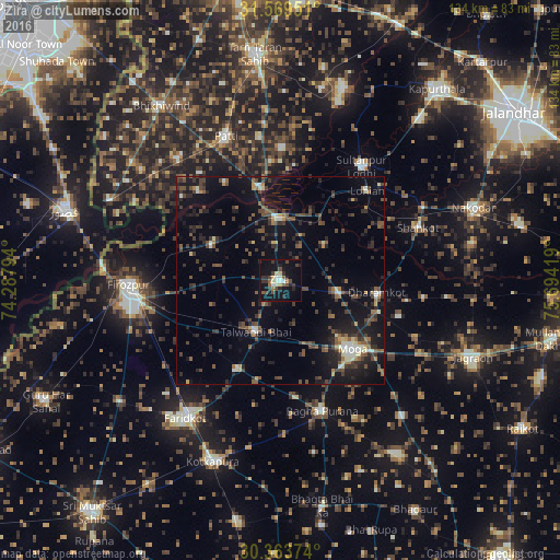
Analysis of Zira night lights 2016
Square area 10x10 km:
 1.1%
1.1%90-99
4.58%80-89
2.56%70-79
0.55%60-69
1.47%50-59
3.85%40-49
6.23%30-39
4.4%20-29
7.88%10-19
26.19%0-9
41.21%Square area 50x50 km:
0.5%90-99
1.36%80-89
0.84%70-79
0.67%60-69
1.25%50-59
2.32%40-49
3.46%30-39
3.37%20-29
4.42%10-19
10.82%0-9
70.98%Clear (daylight) street map image can be seen on geolist.org.
Map coordinates:
31° 34' 10.2" North, 74° 17' 16.6" East
30° 58' 6.7" North, 74° 59' 27.8" East
30° 21' 49.5" North, 75° 41' 39.1" East
Some cities around Zira sort by population:
• Moga
24.2 km =15 mi,  135°
135°
• Ferozepore
36.4 km =22.6 mi,  262°
262°
• Bāgha Purāna
32.8 km =20.4 mi,  161°
161°
• Talwandi Bhai
13.8 km =8.6 mi,  205°
205°
• Sultanpur
33.6 km =20.9 mi,  35°
35°
• Shāhkot
35.3 km =21.9 mi,  69°
69°
• Makhu
15 km =9.3 mi,  1°
1°
• Kot Īsa Khān
14.2 km =8.8 mi,  99°
99°
7645176 (p: 31,350)
Sources (retrieved 2019-11-25):
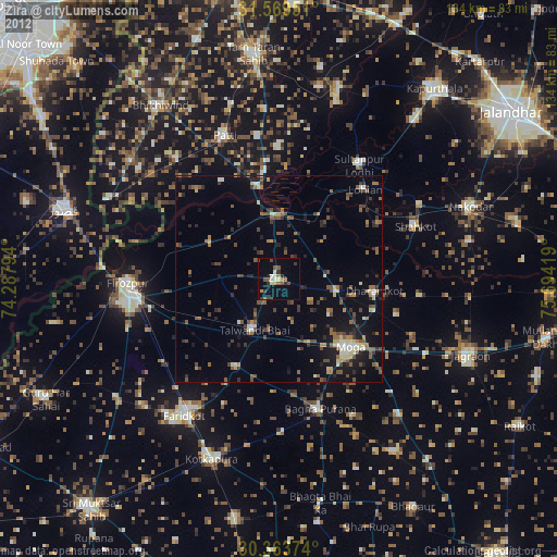
» Earth at Night: Flat Maps 2012, 2016