Kasur night lights from space
Night Light of Kasur (Punjab) from space (Pakistan) Src. Average luminocity for 10x10km area is 37.5568% and for 50x50km: 21.4695%.
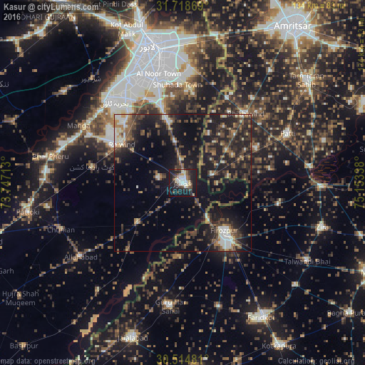
Analysis of Kasur night lights 2016
Square area 10x10 km:
 3.66%
3.66%90-99
8.97%80-89
5.49%70-79
2.38%60-69
2.75%50-59
3.66%40-49
8.06%30-39
5.49%20-29
12.27%10-19
43.04%0-9
4.21%Square area 50x50 km:
1.32%90-99
2.88%80-89
1.44%70-79
1.48%60-69
2.3%50-59
4.18%40-49
6.45%30-39
5.45%20-29
9.26%10-19
19.78%0-9
45.45%Clear (daylight) street map image can be seen on geolist.org.
Map coordinates:
31° 43' 7.3" North, 73° 44' 49.7" East
31° 7' 7.2" North, 74° 27' 0.9" East
30° 30' 53.3" North, 75° 9' 12.2" East
Some cities around Kasur sort by population:
• Ferozepore, IN
26.5 km =16.5 mi,  144°
144°
• Kot Radha Kishan
33.7 km =20.9 mi,  279°
279°
• Kahna Nau
28.7 km =17.8 mi,  344°
344°
• Patti, IN
42.8 km =26.6 mi,  65°
65°
• Raiwind
26.6 km =16.5 mi,  302°
302°
• Raja Jang
21.8 km =13.5 mi, 301°
• Guru Har Sahāi, IN
45.8 km =28.5 mi,  185°
185°
• Khem Karan, IN
10.8 km =6.7 mi, 74°
1174625 (p: 290,643)
Sources (retrieved 2019-11-25):
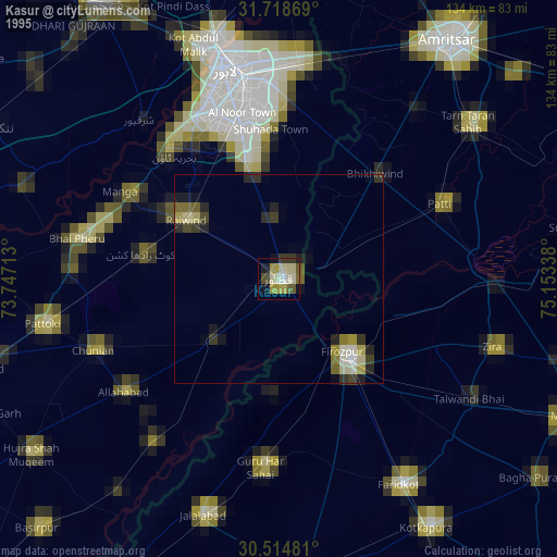
» NASA, Earths city lights 1995
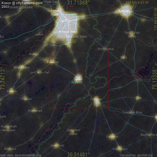
» NASA city lights 2003
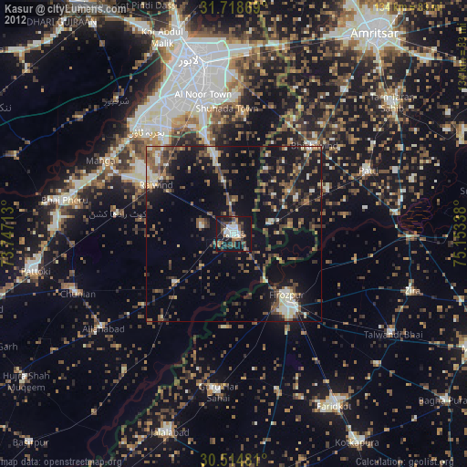
» Earth at Night: Flat Maps 2012, 2016