Pāliyād night lights from space
Night Light of Pāliyād (Gujarat) from space (India) Src. Average luminocity for 10x10km area is 4.6856% and for 50x50km: 5.0116%.
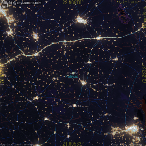
Analysis of Pāliyād night lights 2016
Square area 10x10 km:
 0%
0%90-99
0.57%80-89
0.95%70-79
0%60-69
0.76%50-59
1.52%40-49
0.76%30-39
0%20-29
2.27%10-19
0%0-9
93.18%Square area 50x50 km:
0.05%90-99
0.23%80-89
0.56%70-79
0.64%60-69
0.85%50-59
0.98%40-49
1.24%30-39
1.54%20-29
1.16%10-19
1.24%0-9
91.52%Clear (daylight) street map image can be seen on geolist.org.
Map coordinates:
22° 54' 24.4" North, 70° 51' 25.6" East
22° 15' 27.3" North, 71° 33' 36.9" East
21° 36' 19.2" North, 72° 15' 48.1" East
Some cities around Pāliyād sort by population:
• Botād
14.7 km =9.1 mi,  131°
131°
• Jasdan
43.8 km =27.2 mi,  235°
235°
• Limbdi
42.8 km =26.6 mi,  36°
36°
• Dhandhuka
46 km =28.6 mi,  72°
72°
• Gadhada
32.1 km =19.9 mi,  176°
176°
• Sāyla
33.4 km =20.8 mi,  346°
346°
• Chotila
41.7 km =25.9 mi,  296°
296°
• Vinchia
19.3 km =12 mi,  254°
254°
1260706 (p: 10,862)
Sources (retrieved 2019-11-25):
» Earth at Night: Flat Maps 2012, 2016