Botād night lights from space
Night Light of Botād (Gujarat) from space (India) Src. Average luminocity for 10x10km area is 23.7282% and for 50x50km: 4.3646%.
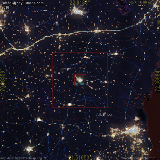
Analysis of Botād night lights 2016
Square area 10x10 km:
 1.19%
1.19%90-99
3.17%80-89
5.16%70-79
1.79%60-69
2.58%50-59
3.37%40-49
6.55%30-39
4.17%20-29
1.79%10-19
17.26%0-9
52.98%Square area 50x50 km:
0.06%90-99
0.27%80-89
0.54%70-79
0.46%60-69
0.69%50-59
0.93%40-49
1.23%30-39
1.04%20-29
1.26%10-19
1.19%0-9
92.35%Clear (daylight) street map image can be seen on geolist.org.
Map coordinates:
22° 49' 7.7" North, 70° 57' 48.9" East
22° 10' 9" North, 71° 40' 0.2" East
21° 30' 59.5" North, 72° 22' 11.4" East
Some cities around Botād sort by population:
• Dhandhuka
40.5 km =25.2 mi,  54°
54°
• Gadhada
24 km =14.9 mi,  202°
202°
• Valabhīpur
38.1 km =23.7 mi,  144°
144°
• Sāyla
46.3 km =28.8 mi,  335°
335°
• Vinchia
29.9 km =18.6 mi,  278°
278°
• Umrāla
38.8 km =24.1 mi,  158°
158°
• Pāliyād
14.7 km =9.1 mi,  311°
311°
• Dhola
33.8 km =21 mi, 161°
1275218 (p: 117,053)
Sources (retrieved 2019-11-25):
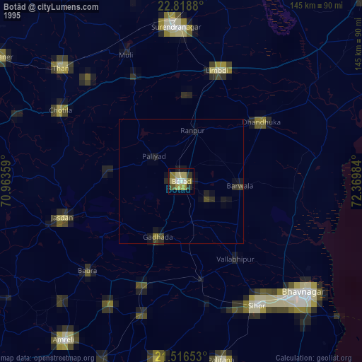
» NASA, Earths city lights 1995
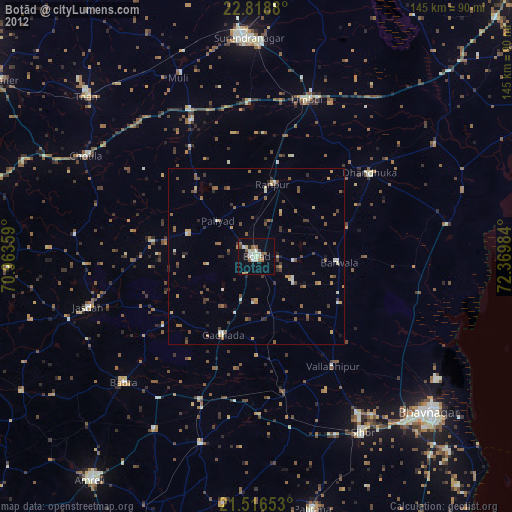
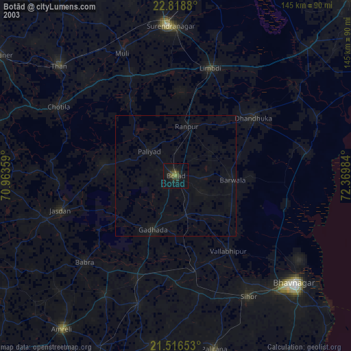
» NASA city lights 2003
» Earth at Night: Flat Maps 2012, 2016