Nyāmti night lights from space
Night Light of Nyāmti (Karnataka) from space (India) Src. Average luminocity for 10x10km area is 2.1797% and for 50x50km: 4.5836%.
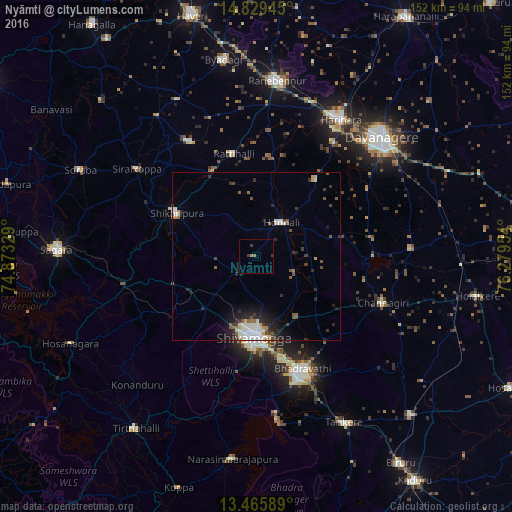
Analysis of Nyāmti night lights 2016
Square area 10x10 km:
 0%
0%90-99
0%80-89
0%70-79
0%60-69
1.3%50-59
0.43%40-49
0.22%30-39
1.95%20-29
0%10-19
0%0-9
96.1%Square area 50x50 km:
0.53%90-99
1.39%80-89
0.23%70-79
0.28%60-69
0.33%50-59
0.74%40-49
0.57%30-39
0.8%20-29
1.38%10-19
2.26%0-9
91.5%Clear (daylight) street map image can be seen on geolist.org.
Map coordinates:
14° 49' 46" North, 74° 52' 23.8" East
14° 8' 55.3" North, 75° 34' 35.1" East
13° 27' 57.2" North, 76° 16' 46.3" East
Some cities around Nyāmti sort by population:
• Shimoga
24.2 km =15 mi,  182°
182°
• Bhadrāvati
36.2 km =22.5 mi,  157°
157°
• Shikārpur
27.3 km =17 mi,  299°
299°
• Channagiri
40.1 km =24.9 mi,  110°
110°
• Honnāli
12.5 km =7.8 mi,  36°
36°
• Hirekerūr
39.3 km =24.4 mi,  330°
330°
• Beltangadi
35 km =21.7 mi,  238°
238°
• Kumsi
21.7 km =13.5 mi, 241°
1261107 (p: 10,338)
Sources (retrieved 2019-11-25):
» Earth at Night: Flat Maps 2012, 2016