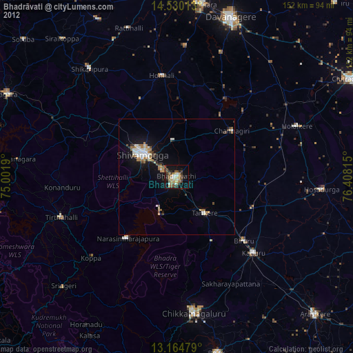
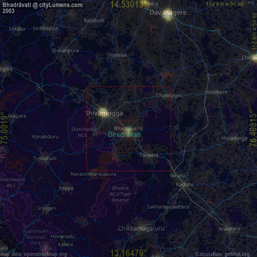
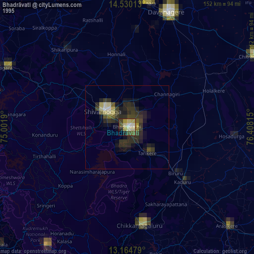
Bhadrāvati night lights from space
Night Light of Bhadrāvati (Karnataka) from space (India) Src. Average luminocity for 10x10km area is 57.0455% and for 50x50km: 9.4641%.
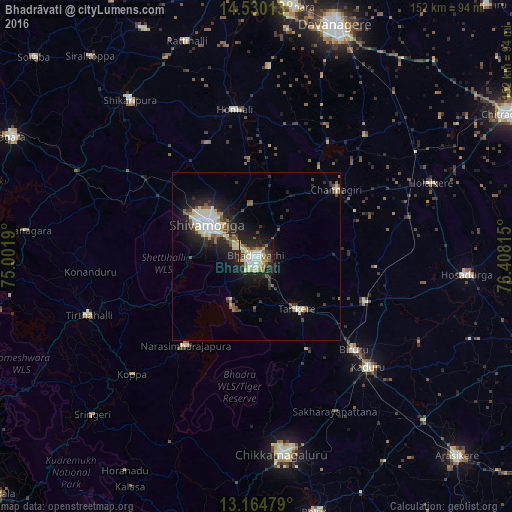
Analysis of Bhadrāvati night lights 2016
Square area 10x10 km:
 8.68%
8.68%90-99
17.15%80-89
9.5%70-79
7.64%60-69
3.51%50-59
8.88%40-49
5.58%30-39
6.2%20-29
20.25%10-19
11.98%0-9
0.62%Square area 50x50 km:
1.1%90-99
2.34%80-89
1.09%70-79
0.66%60-69
0.64%50-59
1.36%40-49
1.12%30-39
1.38%20-29
3.58%10-19
6.53%0-9
80.2%Clear (daylight) street map image can be seen on geolist.org.
Map coordinates:
14° 31' 48.5" North, 75° 0' 6.8" East
13° 50' 54.5" North, 75° 42' 18.1" East
13° 9' 53.2" North, 76° 24' 29.3" East
Some cities around Bhadrāvati sort by population:
• Shimoga
17.4 km =10.8 mi,  301°
301°
• Tarikere
19.4 km =12.1 mi,  142°
142°
• Birūr
40.1 km =24.9 mi,  134°
134°
• Channagiri
30.8 km =19.1 mi,  50°
50°
• Ajjampur
35.2 km =21.9 mi,  112°
112°
• Nyāmti
36.2 km =22.5 mi,  337°
337°
• Narasimharājapura
33.7 km =20.9 mi,  218°
218°
• Kumsi
40.1 km =24.9 mi, 304°
1276321 (p: 163,903)
Sources (retrieved 2019-11-25):
» NASA, Earths city lights 1995
» NASA city lights 2003
» Earth at Night: Flat Maps 2012, 2016