Neyyāttinkara night lights from space
Night Light of Neyyāttinkara (Kerala) from space (India) Src. Average luminocity for 10x10km area is 24.188% and for 50x50km: 15.1208%.
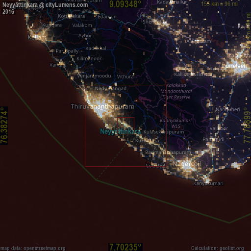
Analysis of Neyyāttinkara night lights 2016
Square area 10x10 km:
 0%
0%90-99
1.65%80-89
0.83%70-79
3.31%60-69
4.13%50-59
1.86%40-49
10.74%30-39
8.88%20-29
11.78%10-19
22.31%0-9
34.5%Square area 50x50 km:
1.16%90-99
1.98%80-89
1.85%70-79
1.89%60-69
2.46%50-59
2.23%40-49
3.68%30-39
3.69%20-29
4.83%10-19
9.34%0-9
66.9%Clear (daylight) street map image can be seen on geolist.org.
Map coordinates:
9° 5' 36.5" North, 76° 22' 57.9" East
8° 23' 54.7" North, 77° 5' 9.1" East
7° 42' 8.5" North, 77° 47' 20.4" East
Some cities around Neyyāttinkara sort by population:
• Thiruvananthapuram
17.9 km =11.1 mi,  302°
302°
• Nedumangād
24.5 km =15.2 mi,  337°
337°
• Colachel
30.9 km =19.2 mi,  142°
142°
• Kuzhithurai
14.7 km =9.1 mi,  127°
127°
• Padmanābhapuram
31.5 km =19.6 mi,  122°
122°
• Manavālakurichi
36.9 km =22.9 mi, 139°
• Eraniel
33.3 km =20.7 mi, 130°
• Kovalam
10.4 km =6.5 mi,  250°
250°
1261470 (p: 88,104)
Sources (retrieved 2019-11-25):
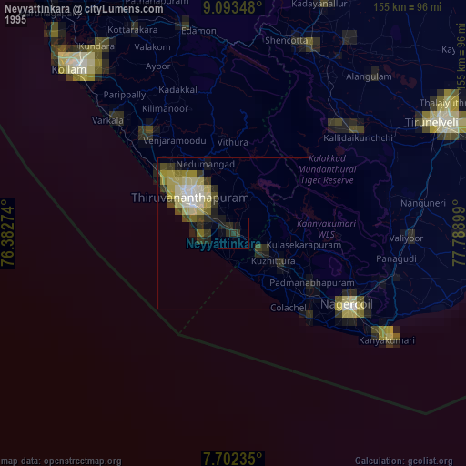
» NASA, Earths city lights 1995
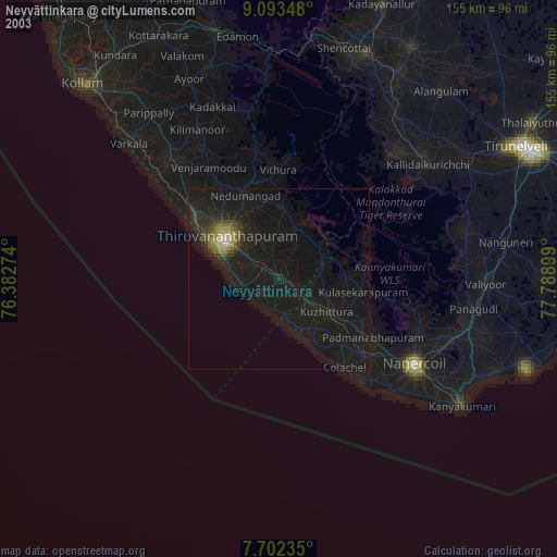
» NASA city lights 2003
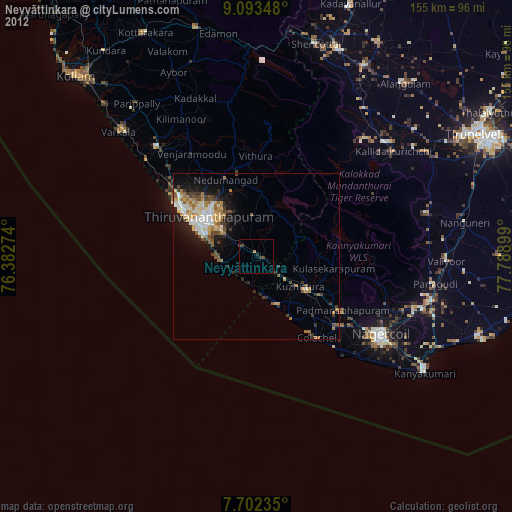
» Earth at Night: Flat Maps 2012, 2016