Kuzhithurai night lights from space
Night Light of Kuzhithurai (Tamil Nadu) from space (India) Src. Average luminocity for 10x10km area is 21.7934% and for 50x50km: 11.7922%.
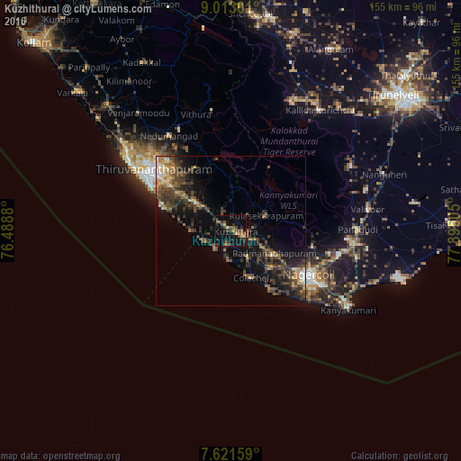
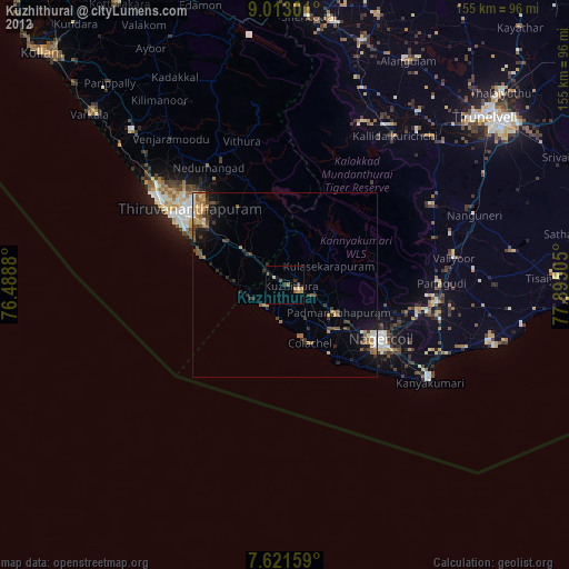
Analysis of Kuzhithurai night lights 2016
Square area 10x10 km:
 0%
0%90-99
0%80-89
4.13%70-79
0.83%60-69
3.31%50-59
4.55%40-49
5.99%30-39
8.47%20-29
6.2%10-19
27.07%0-9
39.46%Square area 50x50 km:
0.47%90-99
0.88%80-89
1.08%70-79
1.18%60-69
2.11%50-59
1.93%40-49
3.77%30-39
4.27%20-29
3.8%10-19
8.96%0-9
71.56%Clear (daylight) street map image can be seen on geolist.org.
Map coordinates:
9° 0' 46.8" North, 76° 29' 19.7" East
8° 19' 4.5" North, 77° 11' 30.9" East
7° 37' 17.7" North, 77° 53' 42.2" East
Some cities around Kuzhithurai sort by population:
• Thiruvananthapuram
32.6 km =20.3 mi,  304°
304°
• Nāgercoil
30.6 km =19 mi,  120°
120°
• Neyyāttinkara
14.7 km =9.1 mi,  307°
307°
• Colachel
17 km =10.6 mi,  154°
154°
• Padmanābhapuram
16.8 km =10.4 mi, 118°
• Manavālakurichi
22.7 km =14.1 mi, 146°
• Eraniel
18.6 km =11.6 mi,  132°
132°
• Kovalam
22.2 km =13.8 mi,  284°
284°
1265387 (p: 20,611)
Sources (retrieved 2019-11-25):
» Earth at Night: Flat Maps 2012, 2016