Nāttarasankottai night lights from space
Night Light of Nāttarasankottai (Tamil Nadu) from space (India) Src. Average luminocity for 10x10km area is 3.9711% and for 50x50km: 3.0928%.
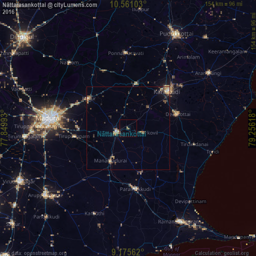
Analysis of Nāttarasankottai night lights 2016
Square area 10x10 km:
 0%
0%90-99
0%80-89
0%70-79
0.41%60-69
2.07%50-59
0.83%40-49
0%30-39
0%20-29
0%10-19
1.45%0-9
95.25%Square area 50x50 km:
0.05%90-99
0.31%80-89
0.44%70-79
0.45%60-69
0.52%50-59
0.49%40-49
0.69%30-39
0.7%20-29
0.7%10-19
1.06%0-9
94.6%Clear (daylight) street map image can be seen on geolist.org.
Map coordinates:
10° 33' 39.7" North, 77° 50' 59.7" East
9° 52' 8.6" North, 78° 33' 11" East
9° 10' 32.2" North, 79° 15' 22.2" East
Some cities around Nāttarasankottai sort by population:
• Kāraikkudi
32.1 km =19.9 mi,  47°
47°
• Paramagudi
36.1 km =22.4 mi,  173°
173°
• Sivaganga
8 km =5 mi,  252°
252°
• Devakottai
30.8 km =19.1 mi,  73°
73°
• Melur
29.6 km =18.4 mi,  307°
307°
• Manamadurai
23.6 km =14.7 mi,  202°
202°
• Tiruppuvanam
32.7 km =20.3 mi,  261°
261°
• Mangalam
15 km =9.3 mi,  140°
140°
1261704 (p: 5,920)
Sources (retrieved 2019-11-25):
» Earth at Night: Flat Maps 2012, 2016