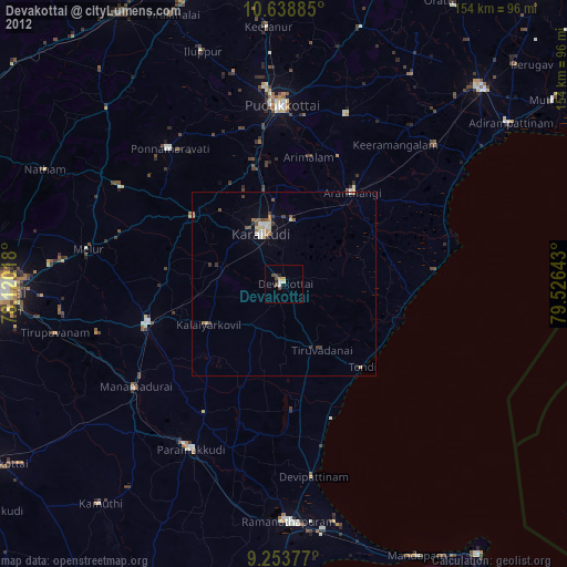
Devakottai night lights from space
Night Light of Devakottai (Tamil Nadu) from space (India) Src. Average luminocity for 10x10km area is 11.7603% and for 50x50km: 3.313%.
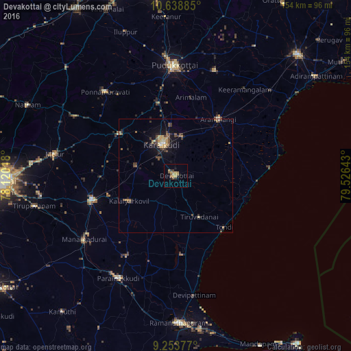
Analysis of Devakottai night lights 2016
Square area 10x10 km:
 0%
0%90-99
0.21%80-89
2.27%70-79
3.93%60-69
2.69%50-59
1.65%40-49
0.83%30-39
1.65%20-29
2.27%10-19
1.65%0-9
82.85%Square area 50x50 km:
0.04%90-99
0.19%80-89
0.61%70-79
0.66%60-69
0.39%50-59
0.47%40-49
0.87%30-39
0.68%20-29
0.56%10-19
2.46%0-9
93.08%Clear (daylight) street map image can be seen on geolist.org.
Map coordinates:
10° 38' 19.9" North, 78° 7' 12.6" East
9° 56' 49.3" North, 78° 49' 23.9" East
9° 15' 13.6" North, 79° 31' 35.1" East
Some cities around Devakottai sort by population:
• Kāraikkudi
14.6 km =9.1 mi,  335°
335°
• Arantāngi
31.1 km =19.3 mi,  36°
36°
• Tondi
31.2 km =19.4 mi,  136°
136°
• Kottaiyūr
18.3 km =11.4 mi,  350°
350°
• Mangalam
28.5 km =17.7 mi,  224°
224°
• Pallattūr
22.2 km =13.8 mi, 354°
• Nambutalai
31.6 km =19.6 mi, 140°
• Nāttarasankottai
30.8 km =19.1 mi,  253°
253°
1273128 (p: 41,568)
Sources (retrieved 2019-11-25):
» Earth at Night: Flat Maps 2012, 2016