Manamadurai night lights from space
Night Light of Manamadurai (Tamil Nadu) from space (India) Src. Average luminocity for 10x10km area is 7.7771% and for 50x50km: 2.6314%.
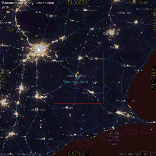
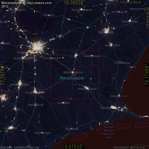
Analysis of Manamadurai night lights 2016
Square area 10x10 km:
 0%
0%90-99
0.43%80-89
1.52%70-79
0.65%60-69
2.38%50-59
1.95%40-49
1.73%30-39
1.3%20-29
1.3%10-19
2.16%0-9
86.58%Square area 50x50 km:
0.03%90-99
0.33%80-89
0.21%70-79
0.46%60-69
0.48%50-59
0.34%40-49
0.69%30-39
0.57%20-29
0.45%10-19
0.5%0-9
95.94%Clear (daylight) street map image can be seen on geolist.org.
Map coordinates:
10° 21' 56.1" North, 77° 46' 4.2" East
9° 40' 23.4" North, 78° 28' 15.5" East
8° 58' 45.7" North, 79° 10' 26.7" East
Some cities around Manamadurai sort by population:
• Paramagudi
19.3 km =12 mi,  137°
137°
• Sivaganga
19.4 km =12.1 mi,  4°
4°
• Tiruppuvanam
28.8 km =17.9 mi,  305°
305°
• Mudukulattūr
37.2 km =23.1 mi,  172°
172°
• Kamuthi
31.4 km =19.5 mi,  199°
199°
• Mangalam
21.2 km =13.2 mi,  61°
61°
• Abirāmam
25.9 km =16.1 mi,  187°
187°
• Nāttarasankottai
23.6 km =14.7 mi,  22°
22°
1263965 (p: 27,493)
Sources (retrieved 2019-11-25):
» Earth at Night: Flat Maps 2012, 2016