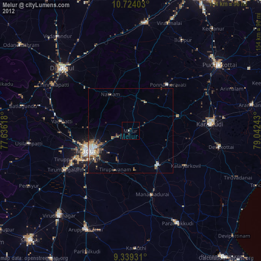
Melur night lights from space
Night Light of Melur (Tamil Nadu) from space (India) Src. Average luminocity for 10x10km area is 11.7025% and for 50x50km: 8.3137%.
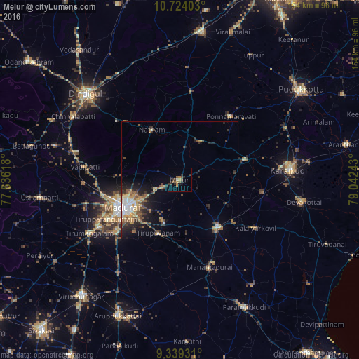
Analysis of Melur night lights 2016
Square area 10x10 km:
 0%
0%90-99
0.83%80-89
0.83%70-79
1.65%60-69
1.65%50-59
3.31%40-49
2.48%30-39
3.72%20-29
3.93%10-19
1.65%0-9
79.96%Square area 50x50 km:
0.84%90-99
1.15%80-89
0.91%70-79
1.42%60-69
0.98%50-59
1.44%40-49
1.46%30-39
1.57%20-29
2.28%10-19
3.7%0-9
84.23%Clear (daylight) street map image can be seen on geolist.org.
Map coordinates:
10° 43' 26.5" North, 77° 38' 10.2" East
10° 1' 56.7" North, 78° 20' 21.5" East
9° 20' 21.5" North, 79° 2' 32.7" East
Some cities around Melur sort by population:
• Madurai
27.2 km =16.9 mi,  242°
242°
• Sivaganga
26 km =16.2 mi,  142°
142°
• Tirupparangunram
33.6 km =20.9 mi, 240°
• Tiruppuvanam
24.7 km =15.3 mi,  201°
201°
• Nattam
24.8 km =15.4 mi,  331°
331°
• Alangānallūr
27.3 km =17 mi,  273°
273°
• Pālamedu
26 km =16.2 mi,  288°
288°
• Nāttarasankottai
29.6 km =18.4 mi,  127°
127°
1263151 (p: 33,839)
Sources (retrieved 2019-11-25):
» Earth at Night: Flat Maps 2012, 2016