Mokameh night lights from space
Night Light of Mokameh (Bihar) from space (India) Src. Average luminocity for 10x10km area is 37.9325% and for 50x50km: 32.915%.
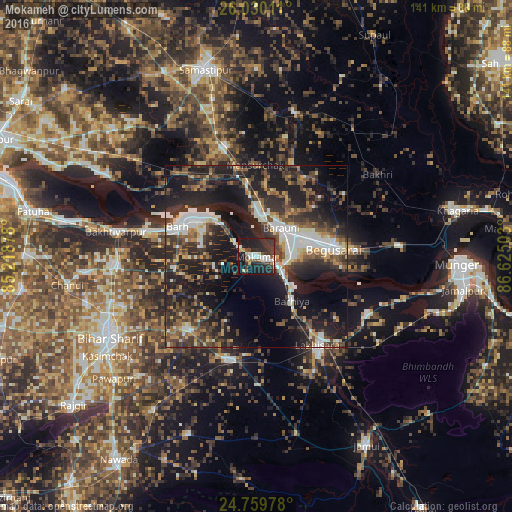
Analysis of Mokameh night lights 2016
Square area 10x10 km:
 6.35%
6.35%90-99
6.75%80-89
2.78%70-79
2.78%60-69
1.79%50-59
5.16%40-49
4.17%30-39
12.3%20-29
23.61%10-19
32.74%0-9
1.59%Square area 50x50 km:
5.32%90-99
5.21%80-89
2.44%70-79
3.04%60-69
3.15%50-59
5.33%40-49
6.07%30-39
8.36%20-29
14%10-19
25.01%0-9
22.06%Clear (daylight) street map image can be seen on geolist.org.
Map coordinates:
26° 1' 48.4" North, 85° 13' 7.6" East
25° 23' 47.8" North, 85° 55' 18.8" East
24° 45' 35.2" North, 86° 37' 30.1" East
Some cities around Mokameh sort by population:
• Begusarai
21.4 km =13.3 mi,  83°
83°
• Luckeesarai
30 km =18.6 mi,  144°
144°
• Bāruni
9.9 km =6.2 mi,  28°
28°
• Bārh
23.4 km =14.5 mi,  294°
294°
• Sheikhpura
29.7 km =18.5 mi,  195°
195°
• Teghra
10.6 km =6.6 mi,  9°
9°
• Barhiya
15.6 km =9.7 mi, 140°
• Bar Bigha
27.4 km =17 mi,  223°
223°
1262852 (p: 55,203)
Sources (retrieved 2019-11-25):
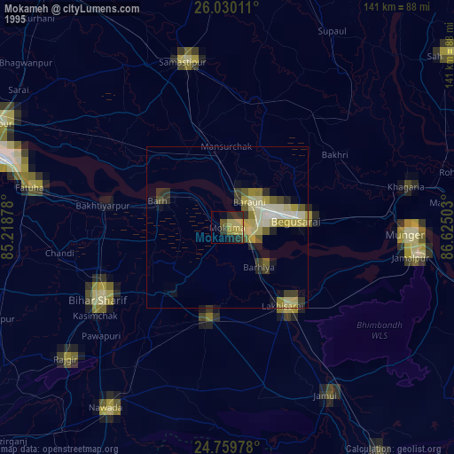
» NASA, Earths city lights 1995
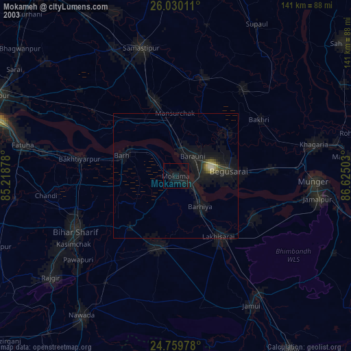
» NASA city lights 2003
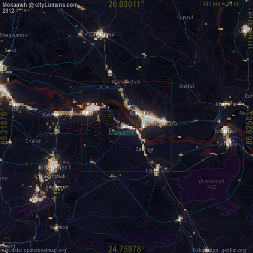
» Earth at Night: Flat Maps 2012, 2016