Mohali night lights from space
Night Light of Mohali (Punjab) from space (India) Src. Average luminocity for 10x10km area is 92.4703% and for 50x50km: 46.4854%.
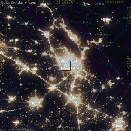
Analysis of Mohali night lights 2016
Square area 10x10 km:
 43.01%
90-99
32.34%80-89
13.11%70-79
2.45%60-69
3.85%50-59
2.8%40-49
1.57%30-39
0.87%20-29
0%10-19
0%0-9
0%Square area 50x50 km:
7.86%90-99
10.08%80-89
6.63%70-79
3.71%60-69
5.28%50-59
7.22%40-49
8.74%30-39
9.06%20-29
12.82%10-19
17.09%0-9
11.51%Clear (daylight) street map image can be seen on geolist.org.
Map coordinates:
31° 16' 57.9" North, 76° 1' 8.4" East
30° 40' 47.8" North, 76° 43' 19.6" East
30° 4' 24.1" North, 77° 25' 30.9" East
Some cities around Mohali sort by population:
• Chandigarh
8.9 km =5.5 mi,  45°
45°
• Panchkula
12.4 km =7.7 mi,  82°
82°
• Rājpura
25.6 km =15.9 mi,  208°
208°
• Kharar
10.3 km =6.4 mi,  315°
315°
• Pinjaur
22.9 km =14.2 mi, 54°
• Morinda
24.6 km =15.3 mi,  299°
299°
• Basi
15.6 km =9.7 mi,  130°
130°
• Banūr
14 km =8.7 mi,  181°
181°
6992326 (p: 123,484)
Sources (retrieved 2019-11-25):
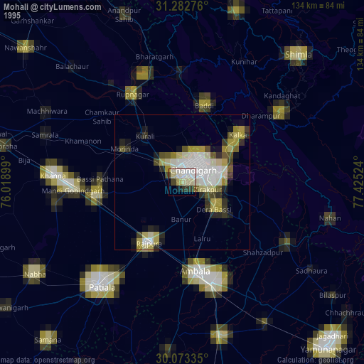
» NASA, Earths city lights 1995
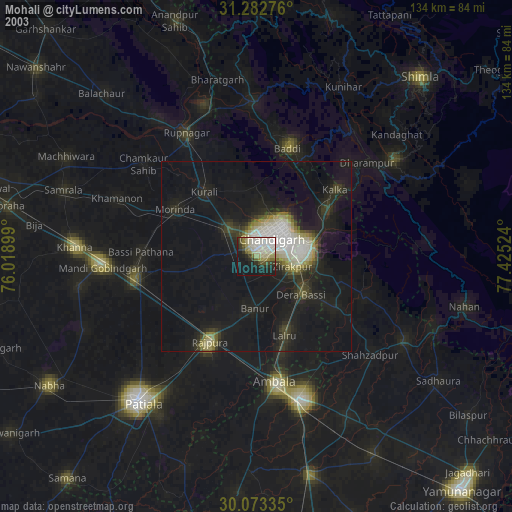
» NASA city lights 2003
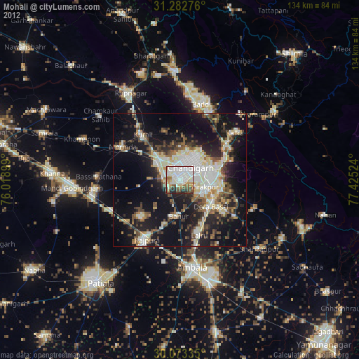
» Earth at Night: Flat Maps 2012, 2016