Chandigarh night lights from space
Night Light of Chandigarh from space (India) Src. Average luminocity for 10x10km area is 96.3881% and for 50x50km: 44.7547%.
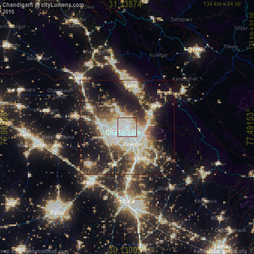
Analysis of Chandigarh night lights 2016
Square area 10x10 km:
 58.57%
90-99
28.85%80-89
8.22%70-79
1.22%60-69
0.87%50-59
2.1%40-49
0.17%30-39
0%20-29
0%10-19
0%0-9
0%Square area 50x50 km:
7.8%90-99
10.05%80-89
6.62%70-79
3.31%60-69
5.05%50-59
6.67%40-49
8.06%30-39
8.42%20-29
11.45%10-19
16.87%0-9
15.7%Clear (daylight) street map image can be seen on geolist.org.
Map coordinates:
31° 20' 19.5" North, 76° 5' 7" East
30° 44' 10.6" North, 76° 47' 18.2" East
30° 7' 48.2" North, 77° 29' 29.5" East
Some cities around Chandigarh sort by population:
• Panchkula
7.5 km =4.7 mi,  128°
128°
• Mohali
8.9 km =5.5 mi,  225°
225°
• Kharar
13.6 km =8.5 mi,  274°
274°
• Kālka
18.5 km =11.5 mi,  51°
51°
• Pinjaur
14.2 km =8.8 mi,  60°
60°
• Basi
17.3 km =10.7 mi,  161°
161°
• Banūr
21.3 km =13.2 mi,  198°
198°
• Parwanoo
20 km =12.4 mi, 55°
1274746 (p: 960,787)
Sources (retrieved 2019-11-25):
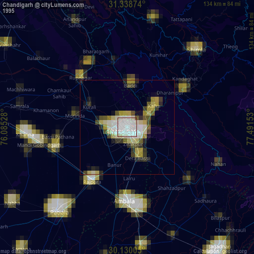
» NASA, Earths city lights 1995
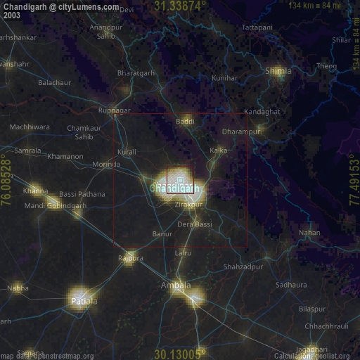
» NASA city lights 2003
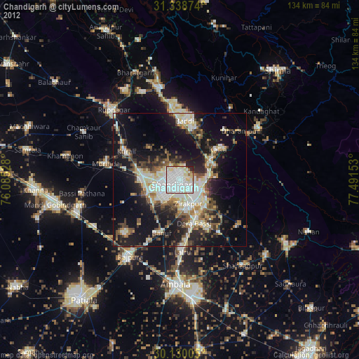
» Earth at Night: Flat Maps 2012, 2016