Meerut night lights from space
Night Light of Meerut (Uttar Pradesh) from space (India) Src. Average luminocity for 10x10km area is 94.2302% and for 50x50km: 46.2937%.
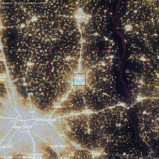
Analysis of Meerut night lights 2016
Square area 10x10 km:
 30.56%
90-99
41.67%80-89
26.19%70-79
1.59%60-69
0%50-59
0%40-49
0%30-39
0%20-29
0%10-19
0%0-9
0%Square area 50x50 km:
3.32%90-99
7.27%80-89
7.73%70-79
5.29%60-69
7.42%50-59
9.59%40-49
12.1%30-39
11.26%20-29
14.12%10-19
19.02%0-9
2.87%Clear (daylight) street map image can be seen on geolist.org.
Map coordinates:
29° 35' 35.8" North, 77° 0' 11.7" East
28° 58' 48.1" North, 77° 42' 22.9" East
28° 21' 47.2" North, 78° 24' 34.2" East
Some cities around Meerut sort by population:
• Mawāna
25 km =15.5 mi,  56°
56°
• Sardhana
20.5 km =12.7 mi,  334°
334°
• Lāwar Khās
16.1 km =10 mi,  25°
25°
• Parīchhatgarh
22.2 km =13.8 mi,  90°
90°
• Kharkhauda
16.3 km =10.1 mi,  167°
167°
• Farīdnagar
24.6 km =15.3 mi,  197°
197°
• Daurāla
14.8 km =9.2 mi,  359°
359°
• Niwāri
20 km =12.4 mi,  234°
234°
1263214 (p: 1,223,184)
Sources (retrieved 2019-11-25):
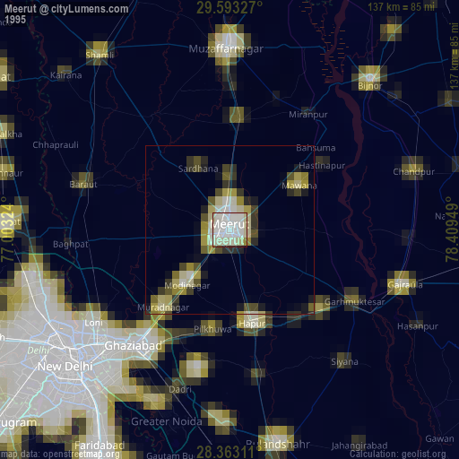
» NASA, Earths city lights 1995
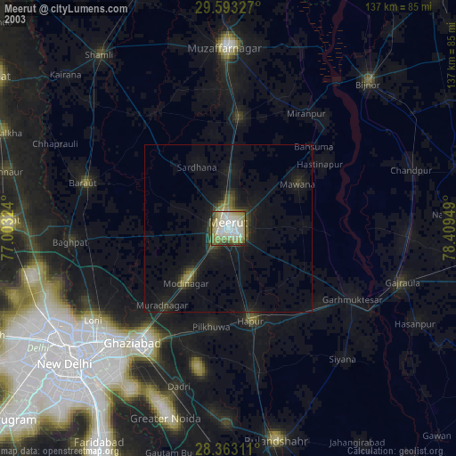
» NASA city lights 2003
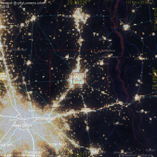
» Earth at Night: Flat Maps 2012, 2016