Sardhana night lights from space
Night Light of Sardhana (Uttar Pradesh) from space (India) Src. Average luminocity for 10x10km area is 49.9881% and for 50x50km: 41.5083%.
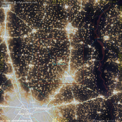
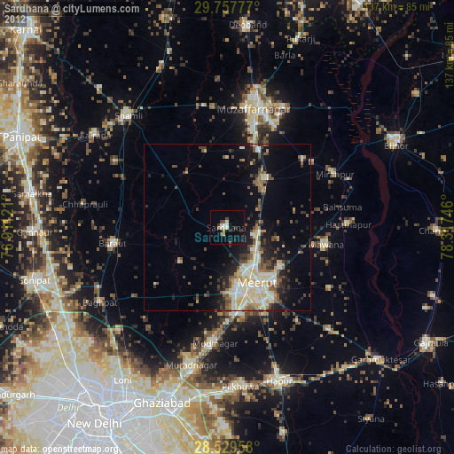
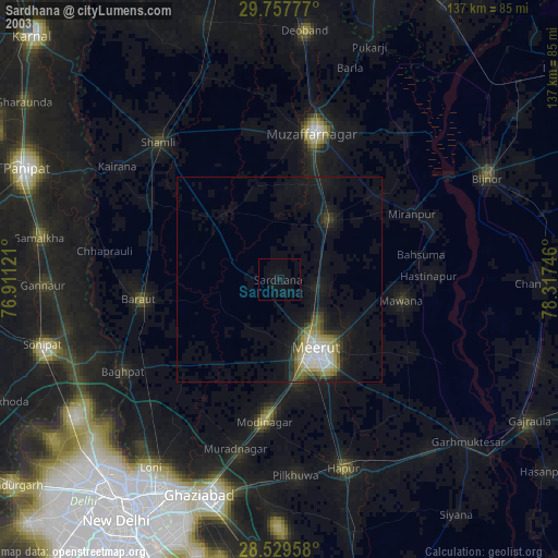
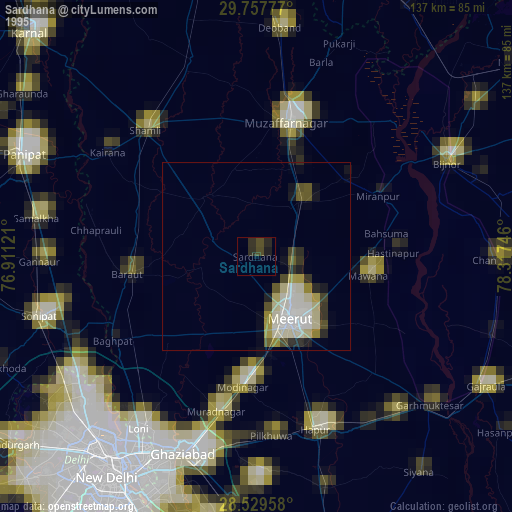
Analysis of Sardhana night lights 2016
Square area 10x10 km:
 1.98%
1.98%90-99
6.55%80-89
9.33%70-79
6.35%60-69
9.92%50-59
6.35%40-49
17.46%30-39
17.86%20-29
22.02%10-19
2.18%0-9
0%Square area 50x50 km:
2.64%90-99
6.19%80-89
6.28%70-79
4.34%60-69
6.13%50-59
8.02%40-49
11.14%30-39
10.43%20-29
14.9%10-19
25.53%0-9
4.39%Clear (daylight) street map image can be seen on geolist.org.
Map coordinates:
29° 45' 28" North, 76° 54' 40.4" East
29° 8' 43.8" North, 77° 36' 51.6" East
28° 31' 46.5" North, 78° 19' 2.9" East
Some cities around Sardhana sort by population:
• Meerut
20.5 km =12.7 mi,  154°
154°
• Khatauli
18.7 km =11.6 mi,  37°
37°
• Budhāna
20.8 km =12.9 mi,  319°
319°
• Lāwar Khās
16.3 km =10.1 mi,  103°
103°
• Shāhpur
23.5 km =14.6 mi,  345°
345°
• Phalauda
21.5 km =13.4 mi,  77°
77°
• Tīkri
26.9 km =16.7 mi,  290°
290°
• Daurāla
9.5 km =5.9 mi,  112°
112°
1257196 (p: 49,857)
Sources (retrieved 2019-11-25):
» NASA, Earths city lights 1995
» NASA city lights 2003
» Earth at Night: Flat Maps 2012, 2016