Masaurhi Buzurg night lights from space
Night Light of Masaurhi Buzurg (Bihar) from space (India) Src. Average luminocity for 10x10km area is 58.9067% and for 50x50km: 60.4294%.
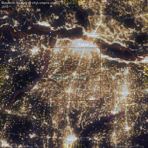
Analysis of Masaurhi Buzurg night lights 2016
Square area 10x10 km:
 4.56%
4.56%90-99
5.56%80-89
7.74%70-79
10.91%60-69
9.52%50-59
25.4%40-49
23.02%30-39
9.72%20-29
3.57%10-19
0%0-9
0%Square area 50x50 km:
6.01%90-99
8.82%80-89
7.78%70-79
9.41%60-69
12.75%50-59
18.44%40-49
19.57%30-39
11.64%20-29
5.57%10-19
0.01%0-9
0%Clear (daylight) street map image can be seen on geolist.org.
Map coordinates:
25° 59' 16.4" North, 84° 19' 43.8" East
25° 21' 15" North, 85° 1' 55" East
24° 43' 1.6" North, 85° 44' 6.3" East
Some cities around Masaurhi Buzurg sort by population:
• Patna
28.6 km =17.8 mi,  21°
21°
• Dinapore
31.5 km =19.6 mi,  2°
2°
• Jahānābād
16.3 km =10.1 mi,  196°
196°
• Khagaul
25 km =15.5 mi, 3°
• Fatwa
32.4 km =20.1 mi,  57°
57°
• Hilsa
25.5 km =15.8 mi,  99°
99°
• Islāmpur
29.5 km =18.3 mi,  143°
143°
• Koelwār
34.5 km =21.4 mi,  316°
316°
1263427 (p: 53,440)
Sources (retrieved 2019-11-25):
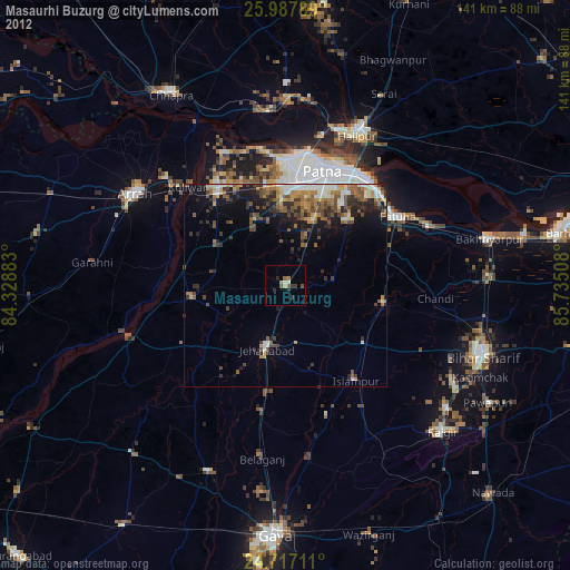
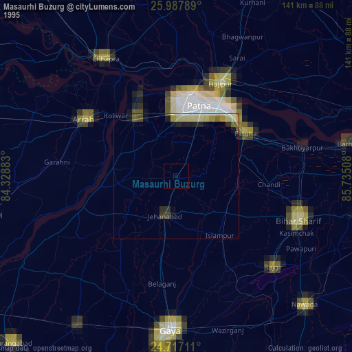
» NASA, Earths city lights 1995
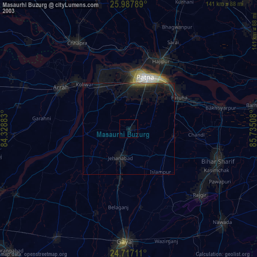
» NASA city lights 2003
» Earth at Night: Flat Maps 2012, 2016