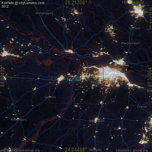
Koelwār night lights from space
Night Light of Koelwār (Bihar) from space (India) Src. Average luminocity for 10x10km area is 50.6098% and for 50x50km: 42.0343%.
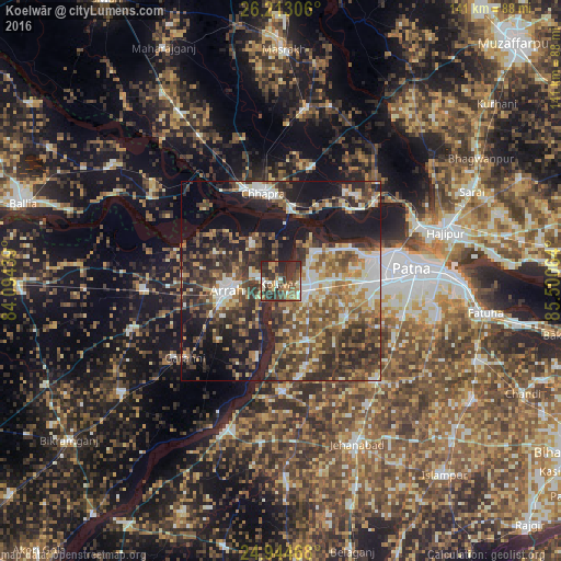
Analysis of Koelwār night lights 2016
Square area 10x10 km:
100  4.73%
4.73%
90-99 7.2%
80-89 4.55%
70-79 6.82%
60-69 9.47%
50-59 12.69%
40-49 7.95%
30-39 20.45%
20-29 24.81%
10-19 1.33%
0-9 0%
4.73%90-99
7.2%80-89
4.55%70-79
6.82%60-69
9.47%50-59
12.69%40-49
7.95%30-39
20.45%20-29
24.81%10-19
1.33%0-9
0%Square area 50x50 km:
100 4.95%
90-99 6.73%
80-89 4.21%
70-79 5.03%
60-69 6.84%
50-59 7.96%
40-49 9.63%
30-39 10.46%
20-29 13.34%
10-19 20.98%
0-9 9.87%
4.95%90-99
6.73%80-89
4.21%70-79
5.03%60-69
6.84%50-59
7.96%40-49
9.63%30-39
10.46%20-29
13.34%10-19
20.98%0-9
9.87%Clear (daylight) street map image can be seen on geolist.org.
Map coordinates:
26° 12' 47" North, 84° 5' 39.8" East
25° 34' 50" North, 84° 47' 51" East
24° 56' 40.8" North, 85° 30' 2.3" East
Some cities around Koelwār sort by population:
• Patna
33.9 km =21.1 mi,  87°
87°
• Arrah
13.7 km =8.5 mi,  258°
258°
• Chāpra
22.8 km =14.2 mi,  347°
347°
• Dinapore
25.9 km =16.1 mi,  75°
75°
• Khagaul
24.9 km =15.5 mi, 90°
• Revelganj
28.3 km =17.6 mi,  325°
325°
• Dighwāra
28 km =17.4 mi,  49°
49°
• Maner
10.5 km =6.5 mi, 46°
1266372 (p: 25,494)
Sources (retrieved 2019-11-25):
» Earth at Night: Flat Maps 2012, 2016