Patna night lights from space
Night Light of Patna (Bihar) from space (India) Src. Average luminocity for 10x10km area is 99.2159% and for 50x50km: 59.0262%.

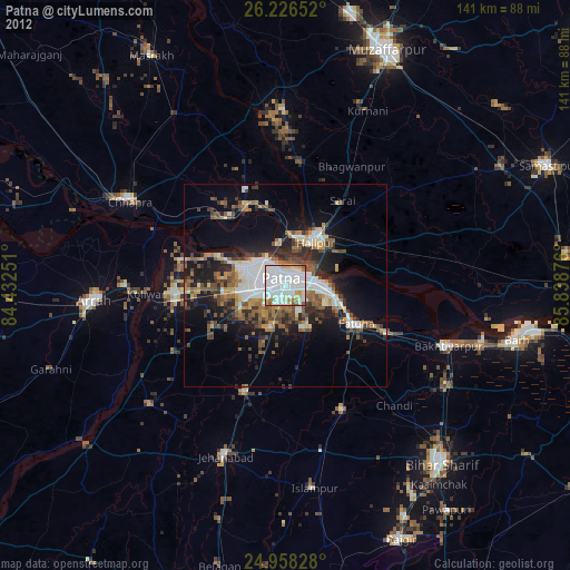
Analysis of Patna night lights 2016
Square area 10x10 km:
 76.52%
90-99
20.83%80-89
2.65%70-79
0%60-69
0%50-59
0%40-49
0%30-39
0%20-29
0%10-19
0%0-9
0%Square area 50x50 km:
11.95%90-99
11.4%80-89
7.03%70-79
8.1%60-69
9.8%50-59
10.59%40-49
12.34%30-39
8.76%20-29
8.16%10-19
10.19%0-9
1.67%Clear (daylight) street map image can be seen on geolist.org.
Map coordinates:
26° 13' 35.5" North, 84° 25' 57" East
25° 35' 38.7" North, 85° 8' 8.3" East
24° 57' 29.8" North, 85° 50' 19.5" East
Some cities around Patna sort by population:
• Dinapore
10 km =6.2 mi,  298°
298°
• Hājīpur
12.6 km =7.8 mi,  36°
36°
• Masaurhi Buzurg
28.6 km =17.8 mi,  201°
201°
• Khagaul
9.2 km =5.7 mi,  259°
259°
• Fatwa
19.4 km =12.1 mi,  118°
118°
• Dighwāra
20.9 km =13 mi,  323°
323°
• Maner
27 km =16.8 mi,  282°
282°
• Khusropur
28 km =17.4 mi, 116°
1260086 (p: 1,599,920)
Sources (retrieved 2019-11-25):
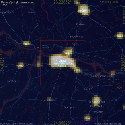
» NASA, Earths city lights 1995
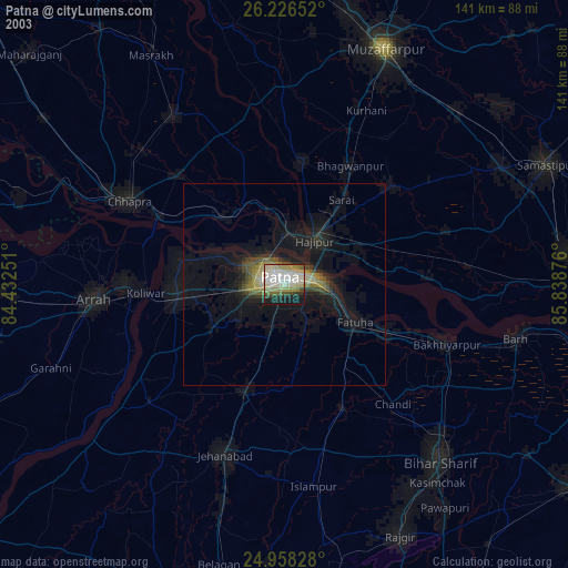
» NASA city lights 2003
» Earth at Night: Flat Maps 2012, 2016