Mālegaon night lights from space
Night Light of Mālegaon (Maharashtra) from space (India) Src. Average luminocity for 10x10km area is 77.2443% and for 50x50km: 8.924%.
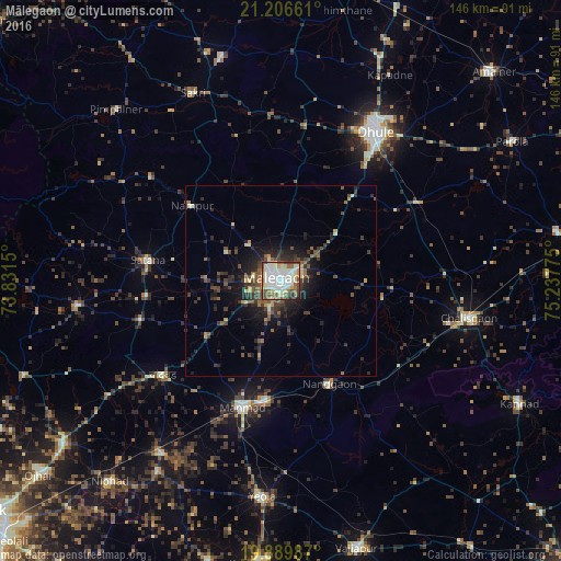
Analysis of Mālegaon night lights 2016
Square area 10x10 km:
 15.72%
90-99
35.98%80-89
8.52%70-79
2.84%60-69
8.52%50-59
11.17%40-49
9.47%30-39
3.6%20-29
3.6%10-19
0.57%0-9
0%Square area 50x50 km:
0.66%90-99
1.77%80-89
0.78%70-79
0.64%60-69
0.87%50-59
1.66%40-49
2.08%30-39
1.97%20-29
3.24%10-19
5.24%0-9
81.09%Clear (daylight) street map image can be seen on geolist.org.
Map coordinates:
21° 12' 23.8" North, 73° 49' 53.4" East
20° 32' 58.8" North, 74° 32' 4.6" East
19° 53' 23.5" North, 75° 14' 15.9" East
Some cities around Mālegaon sort by population:
• Dhūlia
46.5 km =28.9 mi,  32°
32°
• Chālisgaon
51.2 km =31.8 mi,  101°
101°
• Manmād
34.5 km =21.4 mi,  197°
197°
• Yeola
56.6 km =35.2 mi,  184°
184°
• Satānā
34.9 km =21.7 mi,  278°
278°
• Nāndgaon
29.8 km =18.5 mi,  155°
155°
• Chāndor
38.8 km =24.1 mi,  231°
231°
• Lāsalgaon
54.7 km =34 mi,  214°
214°
1264115 (p: 435,362)
Sources (retrieved 2019-11-25):
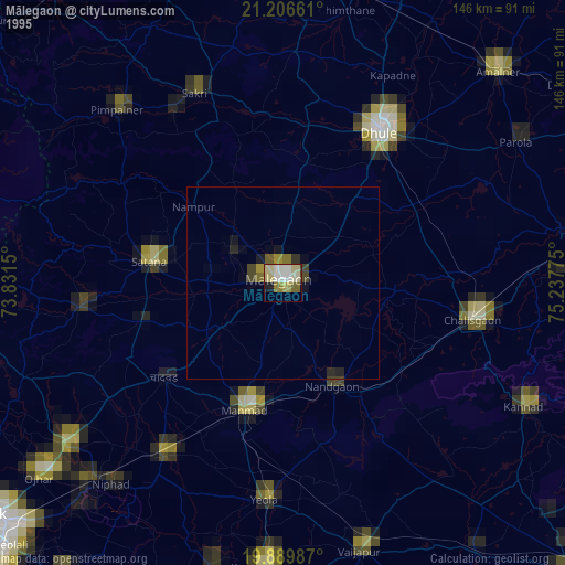
» NASA, Earths city lights 1995
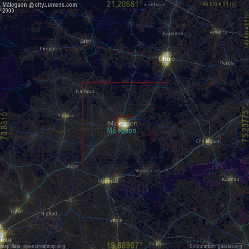
» NASA city lights 2003
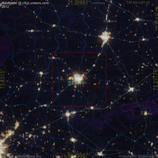
» Earth at Night: Flat Maps 2012, 2016