Mākhjan night lights from space
Night Light of Mākhjan (Maharashtra) from space (India) Src. Average luminocity for 10x10km area is 0% and for 50x50km: 0.3701%.
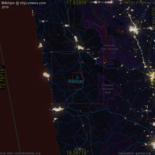
Analysis of Mākhjan night lights 2016
Square area 10x10 km:
 0%
0%90-99
0%80-89
0%70-79
0%60-69
0%50-59
0%40-49
0%30-39
0%20-29
0%10-19
0%0-9
100%Square area 50x50 km:
0%90-99
0.03%80-89
0.03%70-79
0.03%60-69
0%50-59
0.03%40-49
0.13%30-39
0.13%20-29
0%10-19
0.23%0-9
99.38%Clear (daylight) street map image can be seen on geolist.org.
Map coordinates:
17° 56' 24" North, 72° 47' 49.9" East
17° 16' 11.3" North, 73° 30' 1.1" East
16° 35' 49.8" North, 74° 12' 12.4" East
Some cities around Mākhjan sort by population:
• Ratnagiri
36.9 km =22.9 mi,  213°
213°
• Chiplūn
29.3 km =18.2 mi,  1°
1°
• Koynanagar
31.8 km =19.8 mi,  62°
62°
• Khed
51.1 km =31.8 mi,  347°
347°
• Mahābaleshwar
34 km =21.1 mi,  341°
341°
• Lānja
45.8 km =28.5 mi,  173°
173°
• Pātan
44.2 km =27.5 mi,  74°
74°
• Dābhol
49.2 km =30.6 mi,  316°
316°
1264217 (p: 10,000)
Sources (retrieved 2019-11-25):
» Earth at Night: Flat Maps 2012, 2016