Mainpuri night lights from space
Night Light of Mainpuri (Uttar Pradesh) from space (India) Src. Average luminocity for 10x10km area is 65.875% and for 50x50km: 20.2309%.
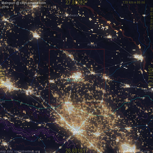
Analysis of Mainpuri night lights 2016
Square area 10x10 km:
 9.28%
9.28%90-99
18.18%80-89
16.29%70-79
3.6%60-69
8.14%50-59
11.93%40-49
10.8%30-39
9.28%20-29
10.8%10-19
1.7%0-9
0%Square area 50x50 km:
0.81%90-99
1.56%80-89
1.69%70-79
1.64%60-69
3.02%50-59
4.11%40-49
5.63%30-39
5.68%20-29
8.65%10-19
23.95%0-9
43.25%Clear (daylight) street map image can be seen on geolist.org.
Map coordinates:
27° 51' 7.3" North, 78° 19' 32.5" East
27° 13' 42.9" North, 79° 1' 43.8" East
26° 36' 5.8" North, 79° 43' 55" East
Some cities around Mainpuri sort by population:
• Bhongaon
15.3 km =9.5 mi,  78°
78°
• Karhal
26.8 km =16.7 mi,  199°
199°
• Alīganj
32.7 km =20.3 mi,  25°
25°
• Bewar
26.6 km =16.5 mi,  92°
92°
• Ghiror
23.7 km =14.7 mi,  259°
259°
• Jasrāna
37.2 km =23.1 mi,  271°
271°
• Kishni
32.3 km =20.1 mi,  134°
134°
• Sakīt
33.7 km =20.9 mi,  312°
312°
1264292 (p: 94,619)
Sources (retrieved 2019-11-25):
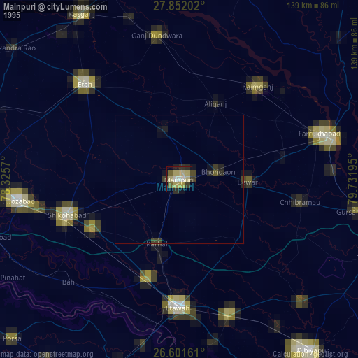
» NASA, Earths city lights 1995
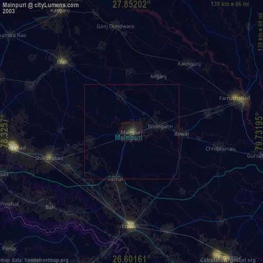
» NASA city lights 2003
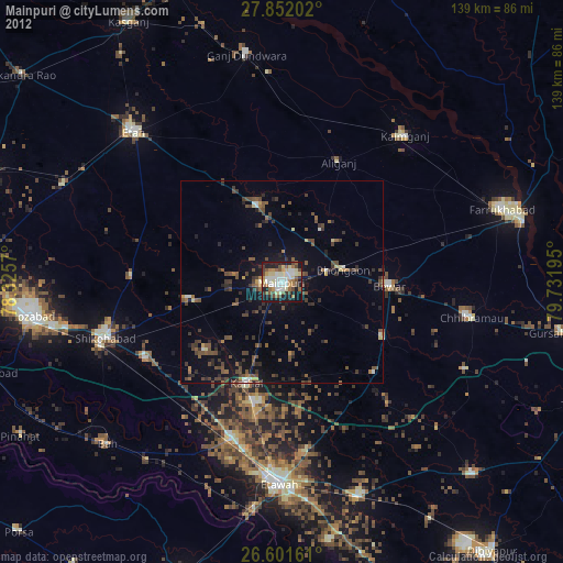
» Earth at Night: Flat Maps 2012, 2016