Mahārājganj night lights from space
Night Light of Mahārājganj (Uttar Pradesh) from space (India) Src. Average luminocity for 10x10km area is 18.5795% and for 50x50km: 19.6476%.
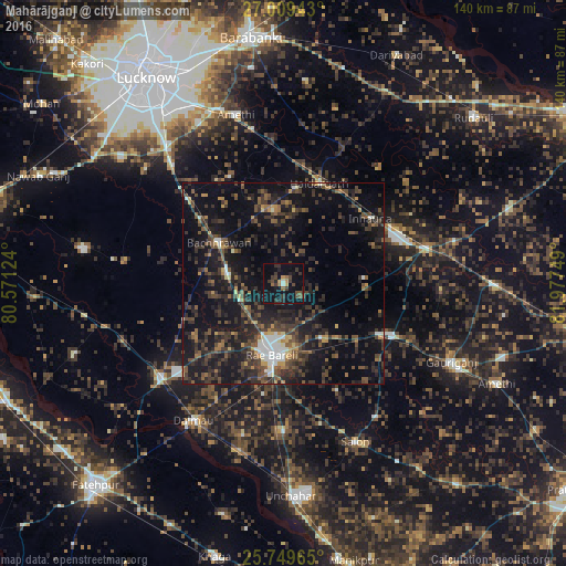
Analysis of Mahārājganj night lights 2016
Square area 10x10 km:
 0.76%
0.76%90-99
0.76%80-89
0%70-79
2.46%60-69
1.7%50-59
3.22%40-49
5.11%30-39
7.95%20-29
6.06%10-19
17.61%0-9
54.36%Square area 50x50 km:
1.14%90-99
1.46%80-89
0.85%70-79
1.61%60-69
1.7%50-59
3.63%40-49
5.73%30-39
7.31%20-29
9.28%10-19
20.21%0-9
47.08%Clear (daylight) street map image can be seen on geolist.org.
Map coordinates:
27° 0' 33.9" North, 80° 34' 16.5" East
26° 22' 52.5" North, 81° 16' 27.7" East
25° 44' 58.7" North, 81° 58' 39" East
Some cities around Mahārājganj sort by population:
• Raebareli
17.2 km =10.7 mi,  193°
193°
• Jais
30.2 km =18.8 mi,  115°
115°
• Maurānwān
39.6 km =24.6 mi,  277°
277°
• Salon
43.1 km =26.8 mi,  155°
155°
• Bachhrāwān
18.7 km =11.6 mi,  302°
302°
• Dalmau
42.8 km =26.6 mi,  214°
214°
• Parshādepur
40.5 km =25.2 mi,  147°
147°
• Nagrām
29.6 km =18.4 mi,  333°
333°
1264434 (p: 6,442)
Sources (retrieved 2019-11-25):
» Earth at Night: Flat Maps 2012, 2016