Lar night lights from space
Night Light of Lar (Uttar Pradesh) from space (India) Src. Average luminocity for 10x10km area is 21.3294% and for 50x50km: 17.4861%.
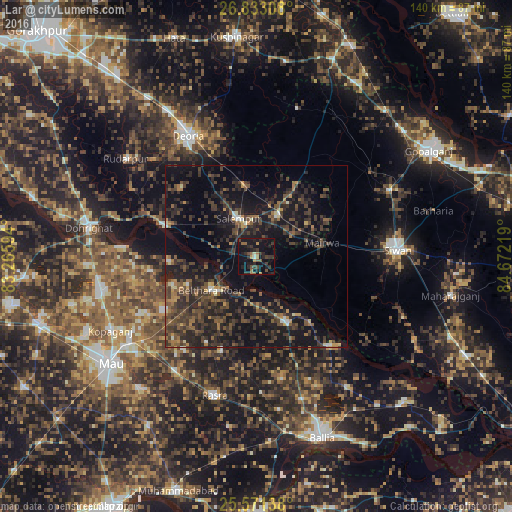
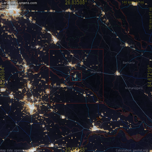
Analysis of Lar night lights 2016
Square area 10x10 km:
 0.4%
0.4%90-99
0.79%80-89
0.4%70-79
3.17%60-69
3.77%50-59
3.17%40-49
4.37%30-39
7.34%20-29
10.52%10-19
29.17%0-9
36.9%Square area 50x50 km:
0.41%90-99
0.72%80-89
0.65%70-79
1.47%60-69
2.19%50-59
3.41%40-49
5.52%30-39
7.24%20-29
9.65%10-19
18.43%0-9
50.3%Clear (daylight) street map image can be seen on geolist.org.
Map coordinates:
26° 49' 59.1" North, 83° 15' 57.4" East
26° 12' 14.2" North, 83° 58' 8.6" East
25° 34' 17" North, 84° 40' 19.9" East
Some cities around Lar sort by population:
• Deoria
38.1 km =23.7 mi,  330°
330°
• Siwān
38.7 km =24 mi,  87°
87°
• Rasrā
40.2 km =25 mi,  196°
196°
• Sikandarpur
19.7 km =12.2 mi,  154°
154°
• Bānsdīh
43.4 km =27 mi, 145°
• Maniar
31.7 km =19.7 mi,  140°
140°
• Mairwa
19.6 km =12.2 mi,  80°
80°
• Bilthra
11.5 km =7.1 mi,  222°
222°
1265053 (p: 26,688)
Sources (retrieved 2019-11-25):
» Earth at Night: Flat Maps 2012, 2016