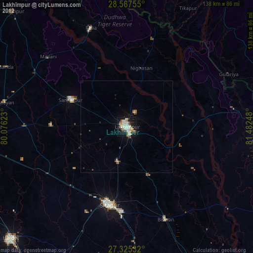
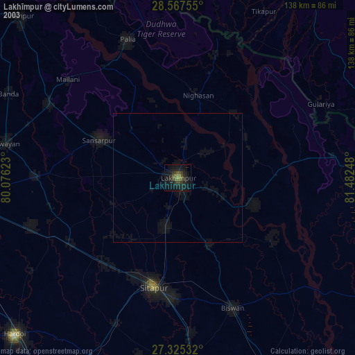
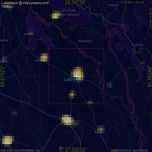
Lakhīmpur night lights from space
Night Light of Lakhīmpur (Uttar Pradesh) from space (India) Src. Average luminocity for 10x10km area is 59.3049% and for 50x50km: 8.5483%.

Analysis of Lakhīmpur night lights 2016
Square area 10x10 km:
 12.12%
90-99
16.48%80-89
6.06%70-79
3.79%60-69
8.14%50-59
7.95%40-49
10.61%30-39
12.69%20-29
15.53%10-19
6.63%0-9
0%Square area 50x50 km:
0.67%90-99
0.93%80-89
0.3%70-79
0.39%60-69
1%50-59
1.39%40-49
2.63%30-39
2.45%20-29
3.67%10-19
6.57%0-9
79.99%Clear (daylight) street map image can be seen on geolist.org.
Map coordinates:
28° 34' 3.2" North, 80° 4' 34.4" East
27° 56' 53.6" North, 80° 46' 45.7" East
27° 19' 31.2" North, 81° 28' 56.9" East
Some cities around Lakhīmpur sort by population:
• Sītāpur
44 km =27.3 mi,  192°
192°
• Gola Gokarannāth
33.6 km =20.9 mi,  295°
295°
• Lāharpur
29.3 km =18.2 mi,  155°
155°
• Khairābād
46.9 km =29.1 mi,  182°
182°
• Kheri
5.3 km =3.3 mi, 160°
• Dhaurahra
31 km =19.3 mi,  79°
79°
• Maholi
43.6 km =27.1 mi,  223°
223°
• Amethi
27.6 km =17.1 mi,  74°
74°
1265242 (p: 140,223)
Sources (retrieved 2019-11-25):
» NASA, Earths city lights 1995
» NASA city lights 2003
» Earth at Night: Flat Maps 2012, 2016