Kheri night lights from space
Night Light of Kheri (Uttar Pradesh) from space (India) Src. Average luminocity for 10x10km area is 40.8731% and for 50x50km: 8.6739%.
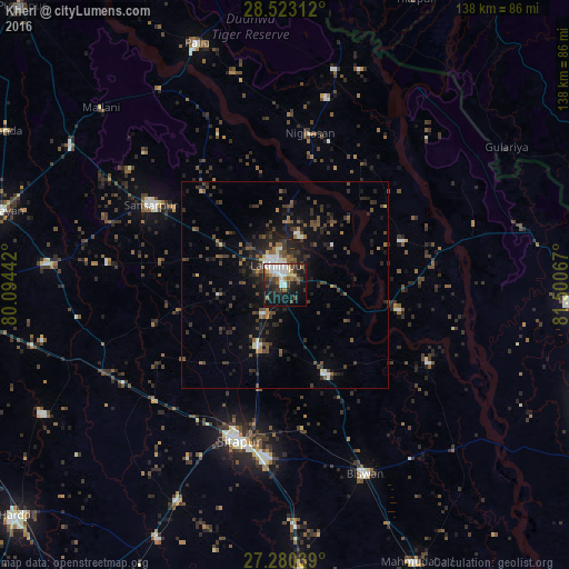
Analysis of Kheri night lights 2016
Square area 10x10 km:
 9.47%
9.47%90-99
8.33%80-89
3.22%70-79
2.08%60-69
4.92%50-59
4.55%40-49
7.77%30-39
9.47%20-29
8.52%10-19
30.11%0-9
11.55%Square area 50x50 km:
0.77%90-99
0.99%80-89
0.36%70-79
0.38%60-69
0.99%50-59
1.31%40-49
2.56%30-39
2.5%20-29
3.6%10-19
6.76%0-9
79.79%Clear (daylight) street map image can be seen on geolist.org.
Map coordinates:
28° 31' 23.2" North, 80° 5' 39.9" East
27° 54' 12.7" North, 80° 47' 51.1" East
27° 16' 49.4" North, 81° 30' 2.4" East
Some cities around Kheri sort by population:
• Sītāpur
39.6 km =24.6 mi,  196°
196°
• Lakhīmpur
5.3 km =3.3 mi,  340°
340°
• Gola Gokarannāth
37.5 km =23.3 mi,  301°
301°
• Lāharpur
24 km =14.9 mi,  154°
154°
• Khairābād
42.1 km =26.2 mi,  185°
185°
• Dhaurahra
30.6 km =19 mi,  69°
69°
• Maholi
41.5 km =25.8 mi,  230°
230°
• Amethi
27.8 km =17.3 mi,  63°
63°
1266762 (p: 26,327)
Sources (retrieved 2019-11-25):
» Earth at Night: Flat Maps 2012, 2016