Nāgercoil night lights from space
Night Light of Nāgercoil (Tamil Nadu) from space (India) Src. Average luminocity for 10x10km area is 68.9112% and for 50x50km: 13.5728%.
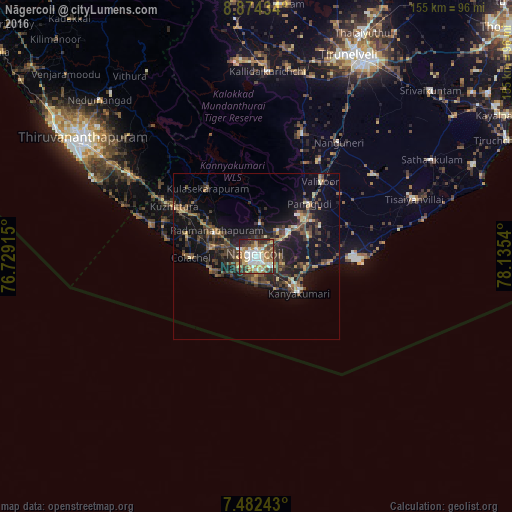
Analysis of Nāgercoil night lights 2016
Square area 10x10 km:
 15.08%
90-99
17.15%80-89
7.02%70-79
12.19%60-69
13.43%50-59
6.4%40-49
10.33%30-39
9.3%20-29
8.88%10-19
0.21%0-9
0%Square area 50x50 km:
0.83%90-99
1.34%80-89
1.04%70-79
1.4%60-69
2.14%50-59
1.99%40-49
3.76%30-39
4.06%20-29
4.38%10-19
13.14%0-9
65.93%Clear (daylight) street map image can be seen on geolist.org.
Map coordinates:
8° 52' 27.6" North, 76° 43' 44.9" East
8° 10' 44.4" North, 77° 25' 56.2" East
7° 28' 56.7" North, 78° 8' 7.4" East
Some cities around Nāgercoil sort by population:
• Vadakku Valliyūr
30.1 km =18.7 mi,  41°
41°
• Colachel
19.2 km =11.9 mi,  270°
270°
• Kuzhithurai
30.6 km =19 mi,  300°
300°
• Kanniyākumāri
15.3 km =9.5 mi,  130°
130°
• Padmanābhapuram
13.8 km =8.6 mi, 301°
• Suchindram
4.7 km =2.9 mi, 125°
• Manavālakurichi
14.4 km =8.9 mi,  256°
256°
• Eraniel
13 km =8.1 mi,  283°
283°
1262204 (p: 213,858)
Sources (retrieved 2019-11-25):
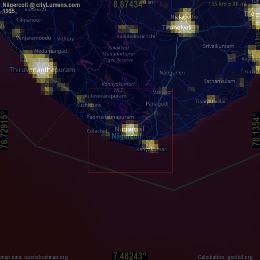
» NASA, Earths city lights 1995
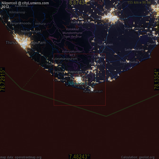
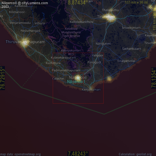
» NASA city lights 2003
» Earth at Night: Flat Maps 2012, 2016