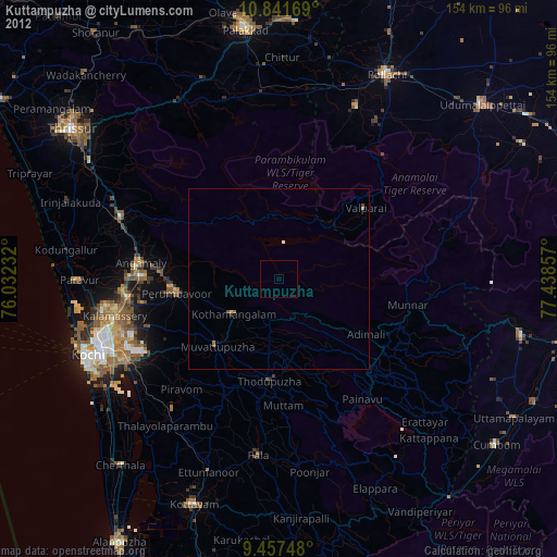
Kuttampuzha night lights from space
Night Light of Kuttampuzha (Kerala) from space (India) Src. Average luminocity for 10x10km area is 0% and for 50x50km: 0.5908%.
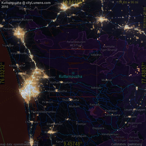
Analysis of Kuttampuzha night lights 2016
Square area 10x10 km:
 0%
0%90-99
0%80-89
0%70-79
0%60-69
0%50-59
0%40-49
0%30-39
0%20-29
0%10-19
0%0-9
100%Square area 50x50 km:
0%90-99
0%80-89
0.07%70-79
0.14%60-69
0.12%50-59
0.04%40-49
0.1%30-39
0.24%20-29
0.1%10-19
0.16%0-9
99.02%Clear (daylight) street map image can be seen on geolist.org.
Map coordinates:
10° 50' 30.1" North, 76° 1' 56.4" East
10° 9' 1.2" North, 76° 44' 7.6" East
9° 27' 26.9" North, 77° 26' 18.9" East
Some cities around Kuttampuzha sort by population:
• Valparai
30.7 km =19.1 mi,  50°
50°
• Munnar
36.4 km =22.6 mi,  100°
100°
• Kotamangalam
15.1 km =9.4 mi,  230°
230°
• Mūvattupula
25.3 km =15.7 mi,  223°
223°
• Muvattupuzha
25.9 km =16.1 mi, 223°
• Perumpāvūr
28.6 km =17.8 mi,  262°
262°
• Perumbavoor
29.1 km =18.1 mi, 260°
• Rāmamangalam
35.3 km =21.9 mi, 226°
1265401 (p: 25,436)
Sources (retrieved 2019-11-25):
» Earth at Night: Flat Maps 2012, 2016