Perumpāvūr night lights from space
Night Light of Perumpāvūr (Kerala) from space (India) Src. Average luminocity for 10x10km area is 27.6095% and for 50x50km: 19.7694%.
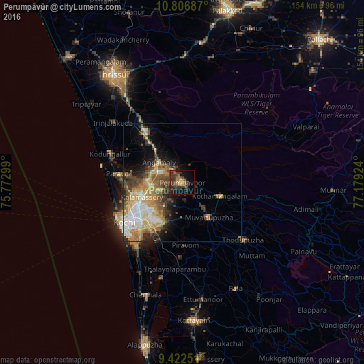
Analysis of Perumpāvūr night lights 2016
Square area 10x10 km:
 0%
0%90-99
0.83%80-89
2.07%70-79
4.13%60-69
7.85%50-59
2.07%40-49
10.12%30-39
14.88%20-29
6.61%10-19
22.31%0-9
29.13%Square area 50x50 km:
2.21%90-99
3.63%80-89
2.91%70-79
3.96%60-69
3.16%50-59
3.01%40-49
3.72%30-39
3.24%20-29
3.01%10-19
5.73%0-9
65.41%Clear (daylight) street map image can be seen on geolist.org.
Map coordinates:
10° 48' 24.7" North, 75° 46' 22.8" East
10° 6' 55.6" North, 76° 28' 34" East
9° 25' 21" North, 77° 10' 45.3" East
Some cities around Perumpāvūr sort by population:
• Kalamassery
17.5 km =10.9 mi,  249°
249°
• Kotamangalam
17.6 km =10.9 mi,  108°
108°
• Angamāli
12.8 km =8 mi,  310°
310°
• Mūvattupula
18.3 km =11.4 mi,  142°
142°
• Muvattupuzha
18.5 km =11.5 mi, 144°
• Aluva
13.7 km =8.5 mi,  266°
266°
• Alwaye
13.3 km =8.3 mi, 265°
• Rāmamangalam
20.4 km =12.7 mi,  172°
172°
1259857 (p: 27,105)
Sources (retrieved 2019-11-25):
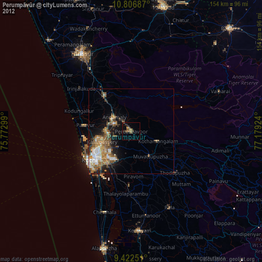
» Earth at Night: Flat Maps 2012, 2016