Kotamangalam night lights from space
Night Light of Kotamangalam (Kerala) from space (India) Src. Average luminocity for 10x10km area is 4.8843% and for 50x50km: 4.4405%.
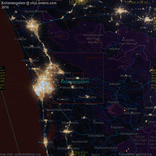
Analysis of Kotamangalam night lights 2016
Square area 10x10 km:
 0%
0%90-99
0%80-89
1.65%70-79
1.03%60-69
0.62%50-59
0.83%40-49
0.83%30-39
0.83%20-29
0.41%10-19
1.24%0-9
92.56%Square area 50x50 km:
0.02%90-99
0.13%80-89
0.26%70-79
0.63%60-69
0.9%50-59
0.72%40-49
1.65%30-39
1.77%20-29
1.6%10-19
3.42%0-9
88.91%Clear (daylight) street map image can be seen on geolist.org.
Map coordinates:
10° 45' 21.2" North, 75° 55' 31.1" East
10° 3' 51.7" North, 76° 37' 42.3" East
9° 22' 16.8" North, 77° 19' 53.6" East
Some cities around Kotamangalam sort by population:
• Angamāli
29.8 km =18.5 mi,  298°
298°
• Mūvattupula
10.5 km =6.5 mi,  212°
212°
• Muvattupuzha
11.1 km =6.9 mi, 212°
• Piravam
26.1 km =16.2 mi, 212°
• Perumpāvūr
17.6 km =10.9 mi,  288°
288°
• Perumbavoor
17.6 km =10.9 mi, 285°
• Kuttampuzha
15.1 km =9.4 mi,  50°
50°
• Rāmamangalam
20.2 km =12.6 mi,  223°
223°
1266031 (p: 37,543)
Sources (retrieved 2019-11-25):
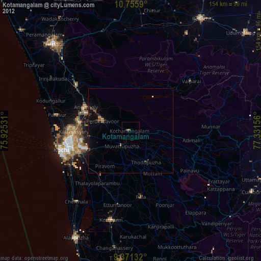
» Earth at Night: Flat Maps 2012, 2016