Kodīnar night lights from space
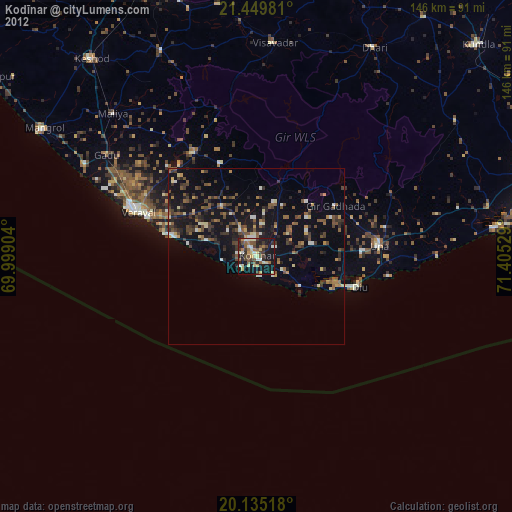
Night Light of Kodīnar (Gujarat) from space (India) Src. Average luminocity for 10x10km area is 43.5492% and for 50x50km: 13.4307%.
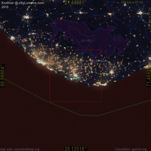
Analysis of Kodīnar night lights 2016
Square area 10x10 km:
100  1.7%
1.7%
90-99 6.82%
80-89 4.17%
70-79 7.77%
60-69 7.77%
50-59 8.14%
40-49 11.36%
30-39 10.61%
20-29 16.67%
10-19 23.67%
0-9 1.33%
1.7%90-99
6.82%80-89
4.17%70-79
7.77%60-69
7.77%50-59
8.14%40-49
11.36%30-39
10.61%20-29
16.67%10-19
23.67%0-9
1.33%Square area 50x50 km:
100 0.14%
90-99 0.81%
80-89 1.01%
70-79 1.33%
60-69 2%
50-59 3.52%
40-49 4.09%
30-39 4.32%
20-29 5.6%
10-19 11.85%
0-9 65.35%
0.14%90-99
0.81%80-89
1.01%70-79
1.33%60-69
2%50-59
3.52%40-49
4.09%30-39
4.32%20-29
5.6%10-19
11.85%0-9
65.35%Clear (daylight) street map image can be seen on geolist.org.
Map coordinates:
21° 26' 59.3" North, 69° 59' 56.5" East
20° 47' 38.1" North, 70° 42' 7.8" East
20° 8' 6.6" North, 71° 24' 19" East
Some cities around Kodīnar sort by population:
• Verāval
37 km =23 mi,  290°
290°
• Māngrol
71.1 km =44.2 mi,  300°
300°
• Una
35.1 km =21.8 mi,  84°
84°
• Dhāri
68.3 km =42.4 mi,  29°
29°
• Diu
30.4 km =18.9 mi,  106°
106°
• Vīsāvadar
60.9 km =37.8 mi,  4°
4°
• Mendarda
64.6 km =40.1 mi,  335°
335°
• Delvāda
35.9 km =22.3 mi,  93°
93°
1266397 (p: 34,930)
Sources (retrieved 2019-11-25):
» Earth at Night: Flat Maps 2012, 2016