Rambha night lights from space
Night Light of Rambha (Odisha) from space (India) Src. Average luminocity for 10x10km area is 7.3182% and for 50x50km: 6.8826%.
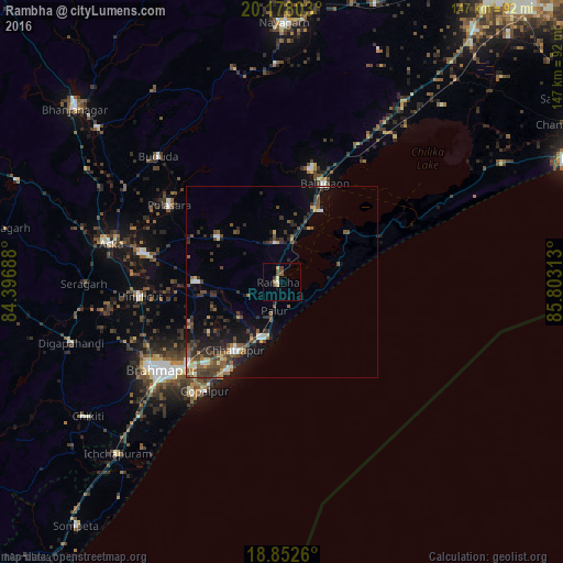
Analysis of Rambha night lights 2016
Square area 10x10 km:
 0%
0%90-99
0.83%80-89
1.65%70-79
0.83%60-69
0.62%50-59
1.45%40-49
3.51%30-39
1.03%20-29
0%10-19
0.83%0-9
89.26%Square area 50x50 km:
0.37%90-99
0.82%80-89
0.54%70-79
0.68%60-69
0.43%50-59
1.68%40-49
1.98%30-39
1.83%20-29
2.32%10-19
4.32%0-9
85.01%Clear (daylight) street map image can be seen on geolist.org.
Map coordinates:
20° 10' 40.9" North, 84° 23' 48.8" East
19° 31' 0" North, 85° 6' 0" East
18° 51' 9.4" North, 85° 48' 11.3" East
Some cities around Rambha sort by population:
• Chatrapur
21.7 km =13.5 mi,  214°
214°
• Polasara
35.9 km =22.3 mi,  303°
303°
• Bānapur
30.1 km =18.7 mi,  14°
14°
• Purushottampur
22.5 km =14 mi,  271°
271°
• Kodala
20.5 km =12.7 mi,  305°
305°
• Khallikot
10.4 km =6.5 mi,  351°
351°
• Ganjām
15.3 km =9.5 mi,  199°
199°
• Gopālpur
35.2 km =21.9 mi,  215°
215°
1258714 (p: 11,276)
Sources (retrieved 2019-11-25):
» Earth at Night: Flat Maps 2012, 2016