Khetia night lights from space
Night Light of Khetia (Maharashtra) from space (India) Src. Average luminocity for 10x10km area is 9.25% and for 50x50km: 3.2077%.
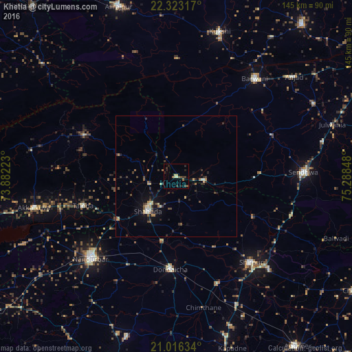
Analysis of Khetia night lights 2016
Square area 10x10 km:
 0%
0%90-99
0.19%80-89
2.08%70-79
0.76%60-69
1.52%50-59
1.7%40-49
2.08%30-39
1.7%20-29
5.11%10-19
0.19%0-9
84.66%Square area 50x50 km:
0.06%90-99
0.36%80-89
0.54%70-79
0.25%60-69
0.41%50-59
0.47%40-49
0.57%30-39
0.82%20-29
1.01%10-19
1.67%0-9
93.85%Clear (daylight) street map image can be seen on geolist.org.
Map coordinates:
22° 19' 23.4" North, 73° 52' 56" East
21° 40' 16.5" North, 74° 35' 7.3" East
21° 0' 58.8" North, 75° 17' 18.5" East
Some cities around Khetia sort by population:
• Nandurbar
49.2 km =30.6 mi,  226°
226°
• Shirpur
47.1 km =29.3 mi,  139°
139°
• Shāhāda
18.3 km =11.4 mi,  220°
220°
• Sendhwa
52.8 km =32.8 mi,  88°
88°
• Barwāni
51.6 km =32.1 mi,  38°
38°
• Dondaicha
38.7 km =24 mi,  182°
182°
• Taloda
40.4 km =25.1 mi,  252°
252°
• Pānsemāl
11.9 km =7.4 mi,  96°
96°
1266746 (p: 15,021)
Sources (retrieved 2019-11-25):
» Earth at Night: Flat Maps 2012, 2016